
Survey, construction, GIS and reality-capture teams needing reliable field positioning and usable observations.
RTK GNSS · Equipment · Field Workflows · Training
Precision Positioning.
Practical Survey Workflows.
From field measurements to georeferenced digital deliverables, Easepect provides RTK GNSS equipment, positioning solutions, training and technical support for surveying, construction and geospatial applications.
Discover Emlid GNSS technology integrated with Emlid Flow, SiReNT correction services and professional GIS and photogrammetry workflows.
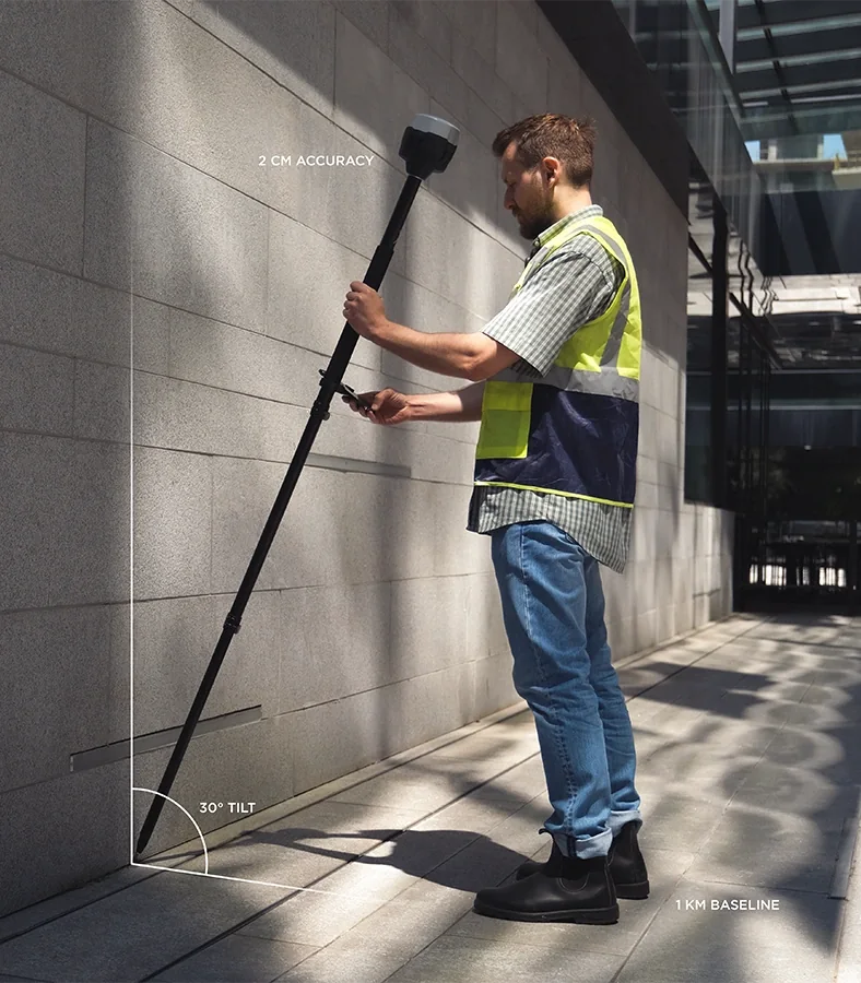
Receiver + correction architectureSVY21 · height references · field QAGIS · photogrammetry · construction
A selected receiver/correction workflow, configured field procedure, observation and check records, or training as scoped.
State the application, site conditions, coordinate and height requirements, existing equipment and team experience.
Discuss your field workflowA positioning system, not a standalone receiver
Field observations you can
trace through the handover.
A useful RTK workflow connects the receiver to a correction source, a defined coordinate and height reference, disciplined observation and an independent check. The equipment specification is only one part of that system.
Easepect helps teams select and configure the equipment, demonstrate the field process and connect the resulting data to GIS, construction and reality-capture workflows. Equipment supply and technical support remain distinct from regulated surveying and professional certification.
Our RTK GNSS solutions
Positioning assigned to
a real field responsibility.
Start with the feature, control or design location that must be observed. The receiver, correction source and verification route follow from that requirement.
01
Construction Site Survey Support
Support site measurements, coordinate collection and construction documentation with appropriate RTK GNSS workflows.
Agree the site control, coordinate reference, observation routine and independent checks before production measurements begin.02
Ground Control Points & Checkpoints
Collect positioned control and independent validation points to support photogrammetry, drone mapping and 3D reality capture.
Control points and independent checkpoints serve different purposes. Their survey method, distribution and acceptance criteria remain project-specific.03
GIS Field Data Collection
Use compatible GNSS receivers and mobile GIS applications to collect georeferenced asset information.
Applications include visible utility assets, infrastructure inventories, site features and field mapping with agreed attributes and export settings.04
Construction Stakeout
Support positioning and set-out workflows using compatible receiver, software and survey-control arrangements.
Design import, localization, antenna offsets and verification procedures must suit the project; equipment support is not regulated survey certification.05
Base & Rover GNSS Systems
Configure RTK base and rover systems for projects requiring independent correction infrastructure or local network transmission.
A correctly established base position and a compatible correction link are essential. Relative precision does not correct an incorrectly positioned base.06
Network RTK with SiReNT
Integrate compatible RTK receivers with Singapore's SiReNT positioning service, subject to subscription, device configuration, reception and project requirements.
A valid service arrangement, correct NTRIP settings and connectivity are required, followed by validation on suitable known control.Emlid product range
Choose the field role.
Then choose the instrument.
Base capability, rover mobility, visual functions, software and correction access are different selection decisions. Product suitability is confirmed for the intended workflow.
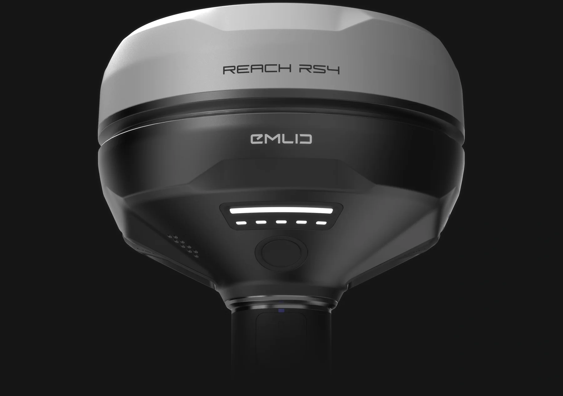
01 / All-band base + rover
Emlid Reach RS4
Professional RTK GNSS receiver supporting base and rover workflows, with tilt compensation.
Explore Reach RS4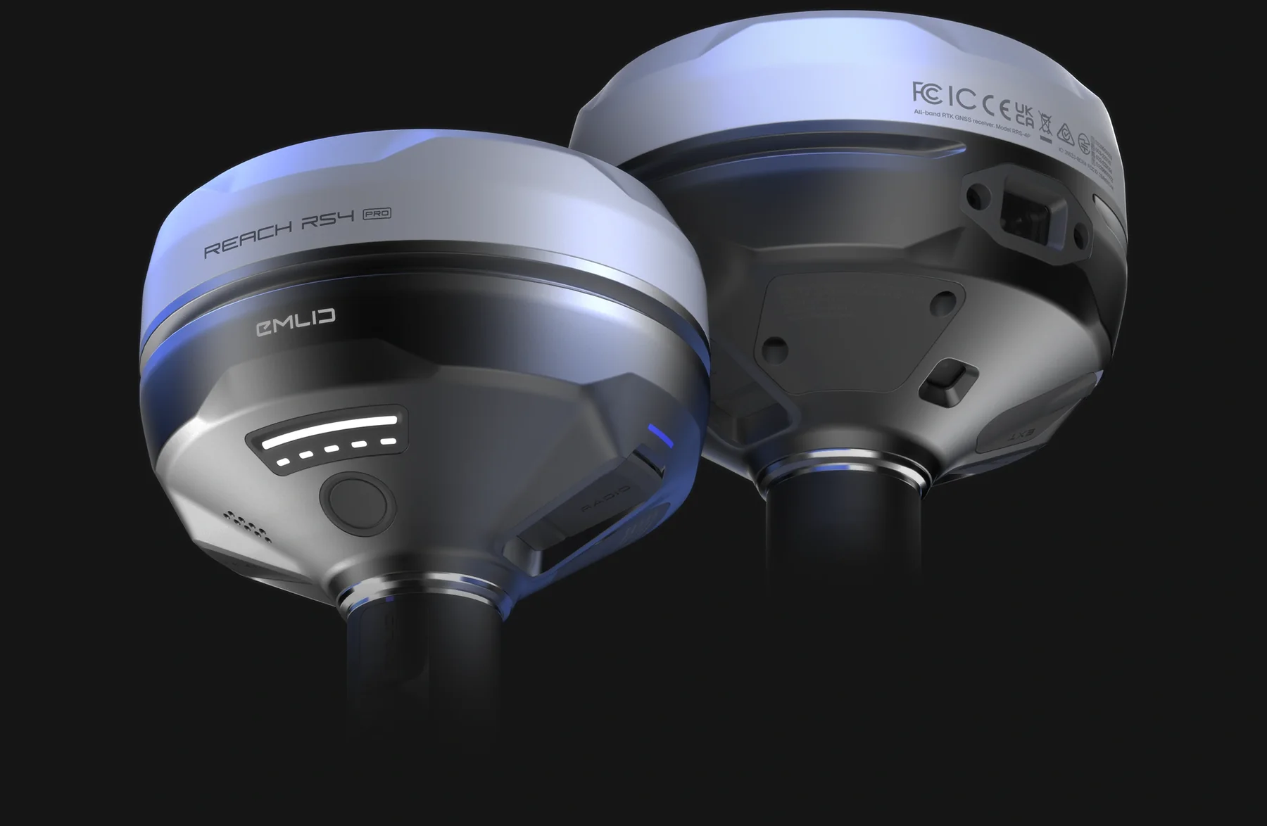
02 / GNSS + visual field functions
Emlid Reach RS4 Pro
RTK GNSS receiver with additional visual field capabilities, including integrated cameras and assisted stakeout functionality.
Explore Reach RS4 Pro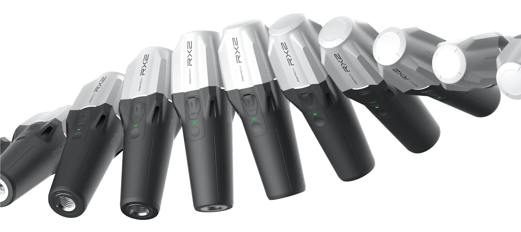
03 / Compact network rover
Emlid Reach RX2
Compact network RTK rover for mobile GIS data collection and supported PIX4Dcatch workflows.
Explore Reach RX204 / Field application
Emlid Flow
Mobile application for receiver configuration, field data collection and project management.
05 / Field-to-office coordinationEmlid Flow 360
Web-based platform for field-to-office data management and synchronisation.
06 / Post-processingEmlid Studio
GNSS post-processing software supporting applicable PPK workflows.
Need to compare base/rover roles, cameras, tilt and mobility?
Use the detailed receiver guide before narrowing the equipment list.
Emlid Flow / genuine interface references
The field-to-office settings
are part of the evidence.
Project configuration, feature collection and coordinate handling belong in the demonstration and training scope—not just receiver hardware setup.
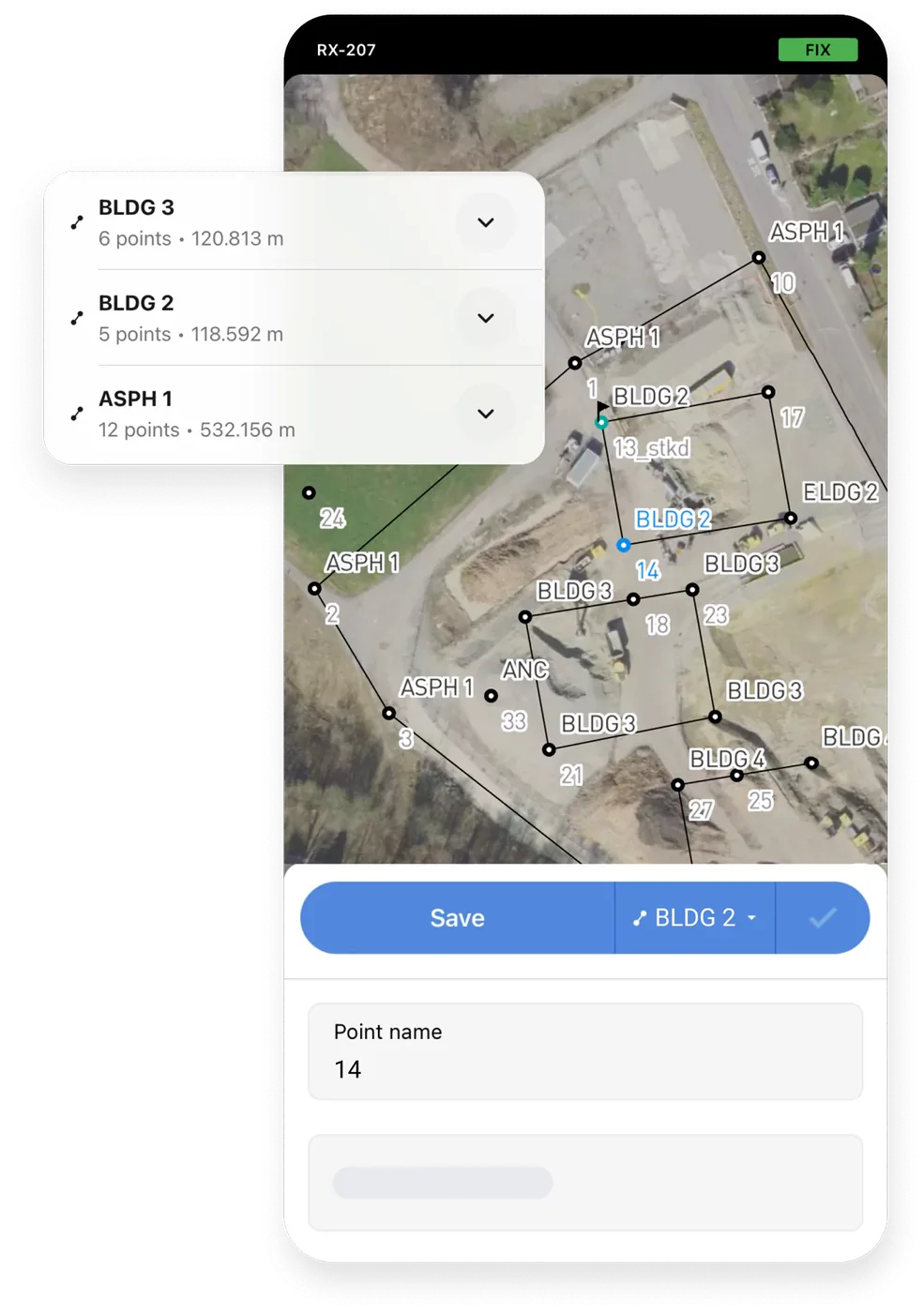
Review project features, observation details and field records in the supported mobile workflow.
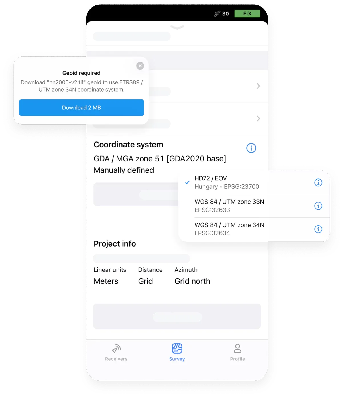
Confirm project settings and coordinate handling before field observations are exported or accepted.
What a practical session covers
01
Receiver and correction-source setup
02
Project coordinate and height-reference decisions
03
Collection, coding and solution-status review
04
Explore Emlid setup and training Official Emlid interface reference images. Available functions depend on the current software, plan and configuration.Known-point checks, exceptions and export
Survey workflow / five quality gates
Configure → Connect → Collect → Validate → Export
Each stage has a concrete configuration or review task. The workflow is adapted to the observation method and receiving system.
01
Configure
Configure the GNSS receiver and project coordinate system.
Receiver role · project CRS · antenna setup02
Connect
Connect to an appropriate RTK correction source.
SiReNT / NTRIP · local base · communication03
Collect
Collect field measurements and associated attributes.
Observation method · solution status · feature codes04
Validate
Review positioning quality, control checks and data completeness.
Known control · independent checks · exceptions05
Export
Export the agreed data for GIS, survey processing or engineering applications.
Format · units · coordinate and height metadataA receiver’s positioning specification does not replace appropriate field checks or Registered Surveyor requirements. Solution status, coordinate configuration, correction quality, antenna setup, observation method and independent evidence all belong in the project review.
Singapore / horizontal + vertical control
Working with Singapore's Survey Reference Systems
Correct coordinate and vertical reference handling is essential to meaningful engineering data. A corrected GNSS position is not automatically expressed in the horizontal and vertical references required by the project.
Define both references before collection, verify the configured system on suitable control and carry the definitions into the handover.
SVY21 / EPSG:3414
SVY21 is Singapore’s projected coordinate system, identified as EPSG:3414. Its eastings and northings are not interchangeable with WGS84 latitude and longitude; units, transformations and delivery settings must be explicit.
Singapore Height Datum
Singapore Height Datum is a vertical reference, not a property established by selecting SVY21. Confirm the project-required levels, benchmark relationships and responsible survey procedure.
SGEOID09 height conversion
SGEOID09 provides a geoid-based relationship between GNSS ellipsoidal heights and geoidal or reduced-level heights. Apply the appropriate model and project procedure, then verify the result against suitable control.
Ellipsoidal height ≠ project level
A GNSS receiver’s ellipsoidal height is referenced to an ellipsoid. It should not be relabelled as an SHD level or a local project elevation without the required vertical treatment and checks.
RTK correction services
A rover requires suitable corrections from a subscribed network or a correctly established local base. Subscription, mountpoint or profile, communication, coordinate output and correction behaviour all require verification.
Handover metadata
Carry the horizontal CRS, vertical reference, units, correction context, antenna-height method, observation dates and quality evidence into the receiving GIS, CAD or engineering environment.
Primary references
Use SLA’s current guidance and service documentation when defining the survey and correction arrangement.
Integration with Easepect solutions
One position.
Several connected workflows.
RTK can support capture, control and GIS tasks without collapsing their separate responsibilities. Compatibility, coordinates and acceptance are verified for the proposed stack.
01 / Mobile reality capture
PIX4Dcatch
Georeference compatible handheld photogrammetry captures. The receiver supplies positioning; image capture, reconstruction and feature interpretation remain separate stages.
02 / Control + validationDrone Mapping
Support ground-control and independent-checkpoint workflows for aerial photogrammetry without assuming that RTK or PPK removes project validation.
03 / Georeferenced evidenceGPC Utility Documentation
Support appropriately designed survey-control and georeferencing workflows for visible, exposed utilities. GPC supplements rather than replaces required utility surveys.
04 / GIS + spatial processingGlobal Mapper
Process, visualise and export geospatial datasets using the capabilities available in the selected subscription, with coordinates and formats checked at handover.
05 / Field-to-office dataGIS Platforms
Collect field information in supported mapping applications and verify geometry, attributes, coordinate reference and version compatibility in the receiving system.
RTK OBSERVATIONCONTROL + QACAPTURE / GISCHECKED HANDOVER
Our services
Procure the equipment.
Implement the workflow.
Engage Easepect for a single receiver, a complete field system, a practical demonstration or integration with an existing geospatial process.
Equipment Supply
Purchase an appropriate Emlid receiver and accessories through Easepect, selected around the intended role, correction source and field workflow.
Request an equipment quoteRTK Setup & Configuration
Assistance with supported receiver setups, correction services and coordinate-reference configuration, followed by appropriate field checks.
Discuss your existing setupField Demonstration & Training
Practical demonstrations covering equipment setup, field collection, quality checks and data export for the team’s actual responsibilities.
Arrange a field sessionWorkflow Implementation
Assistance integrating RTK positioning with existing construction, GIS, photogrammetry and reality-capture processes.
Plan the implementationDemonstrations & technical resources
Go to the primary
product documentation.
Use the manufacturer’s current product and integration guidance, and SLA’s official SiReNT resource, when assessing the complete configuration.
01
Official product overview
02Emlid Reach RS4
Review the manufacturer’s current RS4 product workflow and capabilities.
Official product overview
03Emlid Reach RX2
Review the manufacturer’s compact rover and its intended field role.
Official technical documentation
04Emlid RS4 / RS4 Pro Documentation
Check setup, operation and configuration guidance for the exact receiver and software version.
Official integration guide
05Emlid RX2 and PIX4Dcatch Integration
Follow the documented receiver, mobile-device, correction and capture configuration route.
Official Singapore service resource
SLA SiReNT
Review SiReNT service information, access arrangements and current technical guidance from SLA.
Product functions, subscription scope and integration support can change. Confirm the exact hardware, software version and service arrangement before procurement or field mobilisation.
RTK GNSS FAQ
Field answers before equipment selection.
Understand corrections, site conditions, coordinate references, integration and support before committing to a workflow.
“RTK fixed” is an observation status, not a substitute for independent project verification.
Real-Time Kinematic GNSS applies correction information from a suitable reference source to a rover during observation. It can improve positioning relative to standalone GNSS, but the complete result still depends on the reference coordinates, correction link, satellite signals, site conditions, equipment setup and field procedure.
Manufacturer specifications describe performance under stated conditions; they are not a guaranteed result at every site. Sky visibility, multipath, baseline or network conditions, correction quality, antenna setup, tilt use, coordinate configuration and observation method affect the outcome. Project performance should be evaluated using appropriate control and independent checks.
A base remains at a reference location and supplies correction observations. A rover moves to the features being measured and applies those corrections. RS4 Pro, RS4 and RS3 can support base and rover roles; RX2 is a rover only and requires an external correction source for RTK.
Compatible Emlid rovers can be configured for an appropriate SiReNT NTRIP service. A valid subscription, the correct service configuration and connectivity are required. Validate the setup on suitable known control before production work, and keep passwords or subscription tokens out of the website enquiry form.
Obstructions can reduce satellite visibility and create reflected or degraded signals. A receiver may lose a fixed solution or produce observations that require closer scrutiny. No universal canopy or urban-canyon performance is promised; assess the site, use suitable observation practices and independently verify critical measurements.
RTK applies corrections during the field observation and depends on a suitable real-time correction link. PPK processes stored rover and reference observations after collection. The appropriate route depends on connectivity, equipment support, required outputs and the project QA procedure; neither removes the need for validation.
Yes, suitable receivers can observe ground control points and independent checkpoints for photogrammetry when the survey method and project requirements are defined. Their distribution, coordinate and height references, observation quality and independent verification matter. Do not interpret an RTK/PPK workflow as an unconditional “no GCP” method.
A compatible Reach RX2 configuration can supply RTK positioning to supported PIX4Dcatch iOS workflows. Confirm the current device, application, receiver and correction requirements before capture. GNSS supplies positions; PIX4Dcatch collects imagery and separate photogrammetric processing creates the 3D outputs.
Follow the project specification and responsible survey professional. SVY21, EPSG:3414, is Singapore’s projected coordinate system and is distinct from WGS84 geographic coordinates. Height reference must also be stated separately. Confirm transformations and test the configured workflow against known control rather than assuming a default setting is sufficient.
Ellipsoidal height is referenced to the GNSS ellipsoid; Singapore Height Datum is a vertical reference used for project levels. A suitable geoid-based treatment such as SGEOID09 and any required local procedure may be needed to relate them. The conversion and resulting levels require appropriate verification.
Yes, supported field data can be exported for GIS, CAD or engineering workflows using the formats and functions available in the selected software version. Check geometry, attributes, units, horizontal CRS and vertical reference in the receiving application before issuing the handover.
Yes. Easepect can arrange equipment setup, technical demonstrations and role-based training covering corrections, coordinate settings, field collection, quality checks and export. This technical support does not confer regulated survey qualification, replace a Registered Surveyor where one is required, or guarantee project acceptance.
Equipment / demonstration / implementation
Find the Right RTK Solution for Your Project
Whether you need a single GNSS rover, a complete base-and-rover system or technical support for an existing setup, Easepect can help you select and implement the appropriate solution.
Do not submit sensitive site information through the general enquiry form. NTRIP passwords, subscription tokens and other credentials must not be requested or supplied here.