
FIELD SURVEY / OFFICE COLLABORATION
Emlid Flow and Flow 360 — Connect Field Surveying with Office Workflows
Emlid Flow is the mobile application for configuring Reach receivers, managing corrections and performing survey tasks. Flow 360 is the web-based workspace for project preparation, synchronisation, team coordination and office-side review. Current plan presentation separates Free and Pro capabilities.
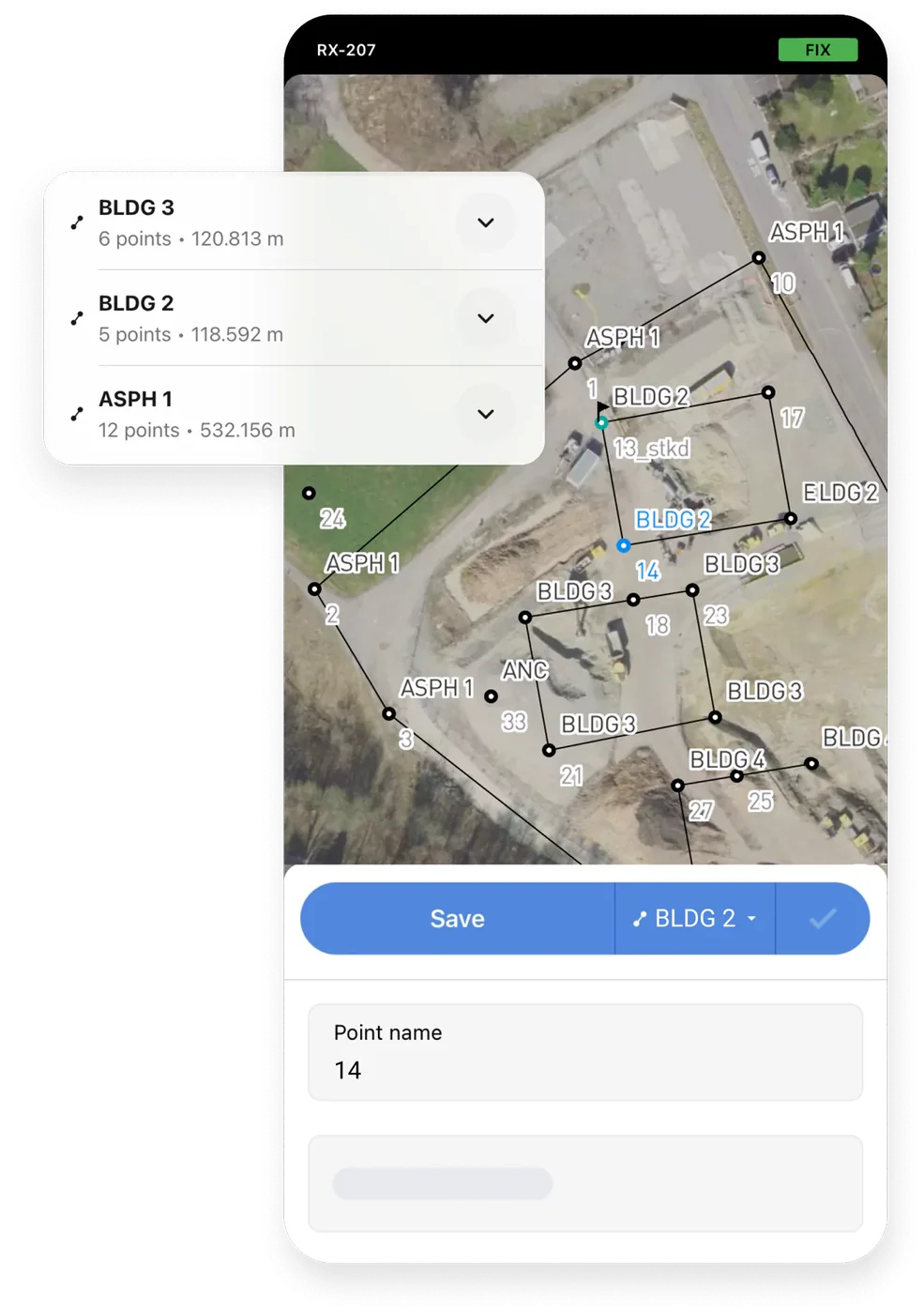
Observed data, configuration and quality evidence remain attached through handover.
01 / PRACTICAL OVERVIEW
Where Emlid Flow and Flow 360 fits in the working system.
Flow connects the receiver to a structured field project. Teams can configure base or rover settings, correction input, coordinate systems and logging, then collect or stake out points and linework with codes and attributes. Flow 360 provides the connected office workspace for supported project and collaboration functions.
Not every advanced function is included in the Free plan. Emlid’s current presentation uses Free and Pro; the former Survey plan was renamed Pro, and existing arrangements may have different individual or team treatment. Confirm the current plan, user count and required features before procurement.
02 / FIELD AND OFFICE CAPABILITIES
A controlled route from receiver settings to project data.
Receiver and corrections
Configure Reach devices, base/rover roles, NTRIP and other supported correction links, position output and raw-data logging.
Collection and stakeout
Collect points and supported linework, use survey codes and attributes, and navigate to design geometry with appropriate field checks.
Coordinates and data exchange
Set project coordinate systems and use supported CSV, DXF, SHP and KML import/export routes. Validate the resulting files in the target system.
Synchronisation and collaboration
Prepare and review projects through Flow 360, synchronise supported field data and manage collaboration according to plan limits.
03 / FREE AND PRO
Select the plan by responsibility.
Feature availability and limits can change. Existing Survey-plan arrangements should be checked against their specific commercial terms.
| Workflow area | Free | Pro |
|---|---|---|
| Receiver configuration and corrections | Core configuration workflow | Included with broader professional functions |
| Point collection, stakeout and coordinate systems | Core survey functions | Included |
| CSV, DXF, SHP and KML exchange | Supported import/export functions | Supported, with additional professional workflows |
| CAD/DTM work, localisation and COGO | Not the core Free feature set | Advanced functions according to current plan |
| Advanced linework, code libraries and reports | Limited by comparison | Expanded professional functions |
| Collaboration and storage | Included with stated limits | More storage and unlimited team members in current presentation |
04 / SINGAPORE ASSET-COLLECTION EXAMPLE
Turn a receiver observation into a usable GIS feature.
01 / Define the schema
Create a code library for asset ID, utility type, material, diameter, installation status and inspection notes, with mandatory fields agreed.
02 / Prepare the project
Set the horizontal and vertical references, correction profile, antenna height, collection method and known-point checks.
03 / Collect and synchronise
Observe visible assets, attach the correct code and note inaccessible or ambiguous features. Synchronise through the approved project route.
04 / Review and export
Check attributes, geometry and coordinates in Flow 360 or the office environment, then export and test the required GIS/CAD files.
05 / COORDINATE CONTROL
Do not confuse a file format with a valid handover.
- Horizontal reference
- WGS84 latitude/longitude and SVY21 eastings/northings are different representations. Define the project CRS and transformation explicitly.
- Height reference
- Ellipsoidal GNSS height and the required project height may differ. Agree geoid or local height treatment and verify against known benchmarks.
- Localisation
- Where a Pro localisation workflow is used, document control, residuals, residuals review and applicability. Do not hide a poor reference behind a fitted transformation.
- Export verification
- Open a sample in the recipient CAD/GIS environment and inspect geometry, attributes, units, CRS and null values before production issue.
06 / IMPLEMENTATION
Train field and office roles separately.
Field operators need correction checks, antenna height, tilt, coding and exception handling. Office users need project setup, plan-aware feature access, synchronisation, coordinate review and export validation. A single generic app demonstration rarely covers both responsibilities.
Easepect can build a representative code library and project template, test the export route and document the operating procedure. Never send NTRIP passwords or subscription tokens through the general enquiry form.
07 / FREQUENTLY ASKED QUESTIONS
Before choosing Emlid Flow and Flow 360.
Flow is the mobile field and receiver-configuration application. Flow 360 is the connected web workspace for project preparation, synchronisation, office review and collaboration. Their exact functions depend on the current plan.
No. The Free plan covers core receiver and survey functions, while Pro adds advanced CAD/DTM, localisation/COGO, linework, reporting and collaboration features. Confirm current limits before deployment.
Emlid renamed Survey to Pro in its current plan presentation. Existing Survey arrangements may have specific individual or team terms, so older licence descriptions should not be reused without checking.
Use the supported project export route in Flow, after confirming the required CRS, geometry and attributes. Test the exported SHP or DXF in the recipient system; format support alone does not validate the handover.
No. Software settings cannot certify a survey. Control, observations, coordinate and height treatment, independent checks, professional responsibility and project acceptance remain separate.
LOCAL IMPLEMENTATION / SINGAPORE
Not sure which Emlid receiver suits your project?
Tell us what you are surveying, your operating environment and required deliverables. Model selection is optional; Easepect can help identify a suitable hardware and software workflow.