
ALL-BAND RTK / BASE + ROVER
Emlid Reach RS4 — Professional All-Band GNSS for Surveying
Reach RS4 is a 672-channel all-band RTK GNSS receiver for base and rover operation, with IMU tilt compensation, RINEX logging and Emlid Flow integration. It suits teams that need professional positioning without the RS4 Pro’s integrated dual-camera visual functions.
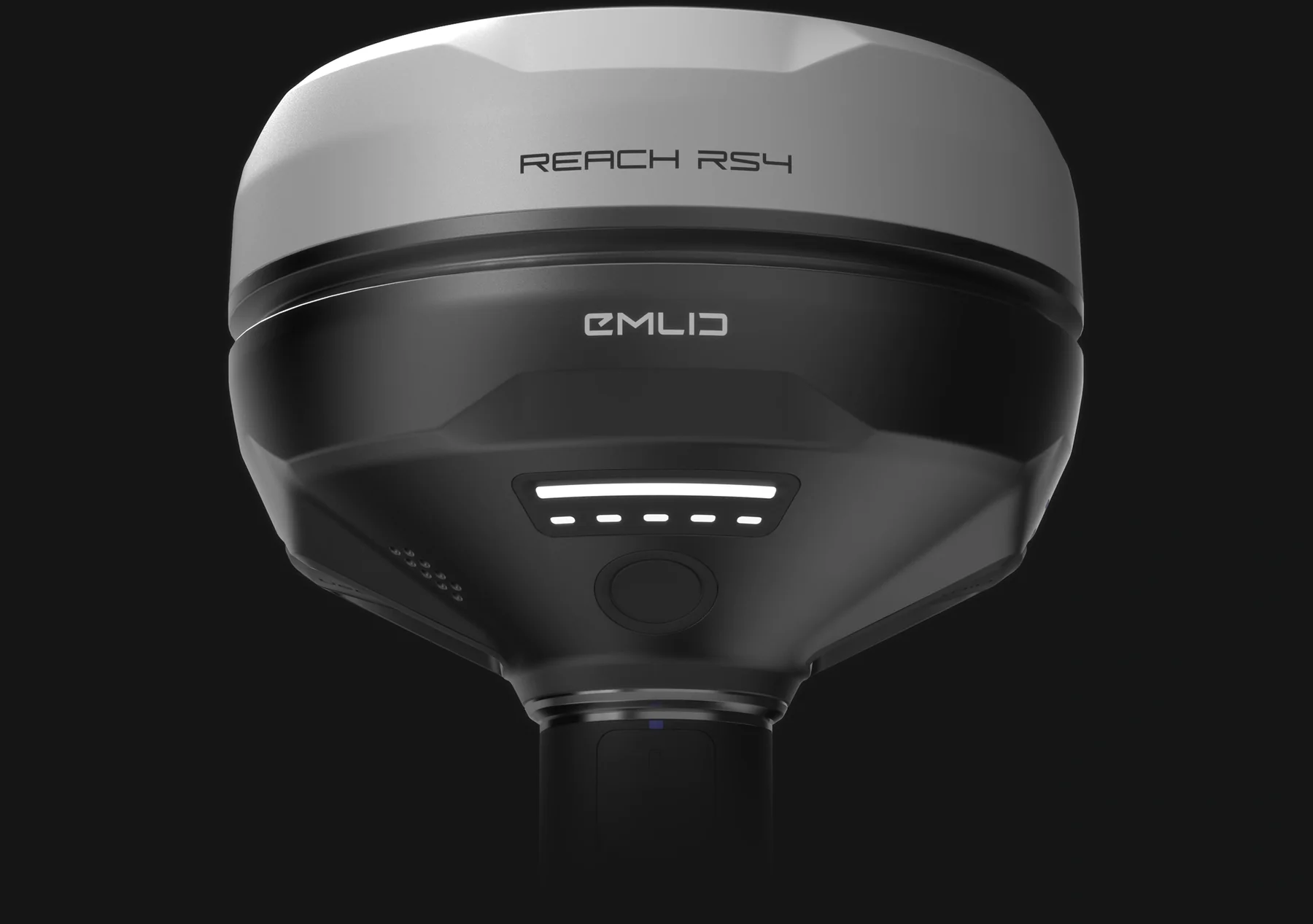
Observed data, configuration and quality evidence remain attached through handover.
01 / PRACTICAL OVERVIEW
Where Reach RS4 fits in the working system.
RS4 is designed for surveyors and mapping teams working across construction, infrastructure, land measurement and drone operations. It can provide corrections as a base or receive them as a rover, and supports real-time and post-processed workflows.
All-band tracking is relevant where satellite reception varies, but no receiver should be expected to perform identically in every environment. Sky visibility, multipath, baseline, correction quality, observation method and project QA remain decisive.
02 / TECHNICAL CAPABILITIES
A flexible measurement and reference platform.
- GNSS
- 672-channel all-band satellite tracking.
- Operating roles
- Base and rover operation for suitable RTK and PPK configurations.
- Tilt
- IMU tilt compensation for supported pole-tip observation workflows.
- Correction links
- NTRIP and compatible LoRa/UHF correction workflows, depending on configuration and project requirements.
- Logging
- RINEX raw-data recording for supported post-processing and reference workflows.
- Physical specification
- 927 g, IP68 protection and up to 16 hours of battery operation under manufacturer conditions.
- Camera distinction
- No integrated RS4 Pro dual-camera AR stakeout or visual-capture functions.
03 / SUGGESTED WORKFLOWS
One receiver across several survey responsibilities.
Topographical surveying
Collect coordinates and elevations for terrain, drainage, infrastructure and site features using an agreed observation and coding method.
Construction surveying
Establish and verify measurement points, set out design features and document as-built conditions with appropriate checks.
Drone base-station workflow
Provide corrections to supported RTK drones where device compatibility, correction format and link configuration have been confirmed.
Control and checkpoints
Observe independent points for photogrammetric control and accuracy assessment, with horizontal and vertical references defined.
04 / BASE AND ROVER DESIGN
Choose the correction architecture before mobilisation.
01 / Establish the base position
Use a known coordinate or an appropriate determination method. Relative precision does not correct an incorrectly positioned base.
02 / Select the link
Choose NTRIP, compatible radio or another supported route by coverage, site constraints, equipment and operating requirements.
03 / Configure the rover
Confirm RTCM input, mountpoint or radio settings, coordinate system, antenna height and tilt procedure.
04 / Log and check
Record required raw observations, check known points and preserve solution and correction information for review.
05 / MODEL COMPARISON
Where RS4 sits in the current range.
| Requirement | RS4 | RS4 Pro | RX2 |
|---|---|---|---|
| Base functionality | Yes | Yes | No |
| All-band / channels | All-band / 672 | All-band / 672 | All-band / 672 |
| Integrated dual cameras | No | Yes | No |
| Weight | 927 g | 943 g | 280 g |
| Typical selection reason | Professional base/rover without cameras | Visual survey functions | Compact network rover and supported mobile capture |
06 / LOCAL IMPLEMENTATION
Build the complete kit and operating procedure.
A base/rover deployment may require more than two receivers: poles, tripod and tribrach, antenna-height method, radio or network arrangements, power, transport and data-export settings should all be scoped. For network rover use, a single RS4 may be sufficient when a suitable correction service is available.
Easepect can configure a representative workflow, test corrections and exports, and train operators on control, checks and common failure modes. Drone integration remains aircraft- and mission-specific.
07 / FREQUENTLY ASKED QUESTIONS
Before choosing Reach RS4.
Yes, it is a strong candidate where all-band base/rover GNSS, tilt compensation and Flow survey functions fit the required work. The site environment, correction architecture and acceptance checks must still be assessed.
No. RS4 does not include the integrated dual-camera AR stakeout and visual-capture functions. Choose RS4 Pro when those specific workflows are required.
It can serve as a base in compatible workflows, but the exact drone, input format, link and coordinate configuration must be checked. Compatibility should never be inferred from the receiver specification alone.
Yes, when it operates as a rover with a suitable external correction service. You need valid service access, connectivity, coverage and an appropriate project QA procedure.
No. Signal blockage and multipath can prevent or degrade a solution. Evaluate the actual environment and use appropriate observation and independent-check procedures.
LOCAL IMPLEMENTATION / SINGAPORE
Not sure which Emlid receiver suits your project?
Tell us what you are surveying, your operating environment and required deliverables. Model selection is optional; Easepect can help identify a suitable hardware and software workflow.