
Contractors and construction engineers who need to perform appropriate routine coordinate, distance, area and positioning tasks on site.
Construction Engineer RTK Solution · Singapore
Construction Site Measurement Made Simple
Give Your Engineers the Freedom to Measure.
Collect coordinates, measure distances and areas, locate design points and document site conditions using a compact GNSS receiver and smartphone.
Easepect helps contractors implement the complete solution—from equipment selection and Singapore coordinate configuration to practical training and ongoing technical support.
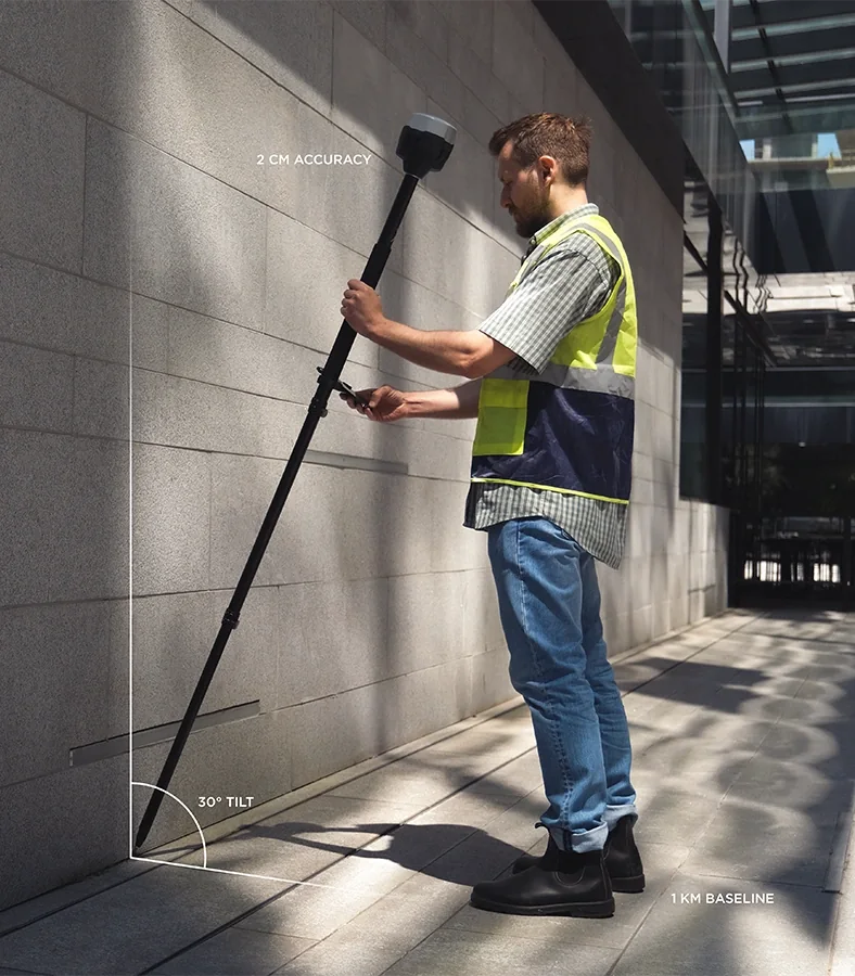 DISTANCE / TWO OBSERVED POINTSILLUSTRATIVE WORKFLOW OVERLAY · NO LIVE VALUES
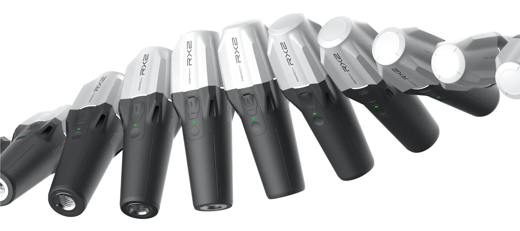 RX2 / COMPACT RTK ROVER
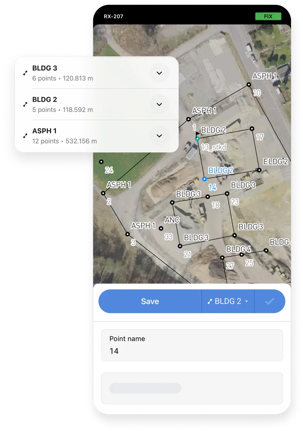 FLOW / MOBILE FIELD RECORD
Engineer-led routine measurementReceiver + corrections + smartphoneSetup · training · local support
Routine engineering capabilities
- Collect coordinates directly on site
- Measure distances and areas
- Locate predefined design points
- Record installed infrastructure
- Export coordinates for CAD and GIS
- Reduce routine measurement delays
- Support informed site decisions
A suitable receiver and mobile workflow, Singapore coordinate configuration, practical training, field-check procedures and scoped technical support.
Tell us how many engineers you want to equip, the tasks they perform, your existing GNSS/CAD workflow and the intended implementation timing.
Plan your engineer RTK kitThe engineering bottleneck
Your Engineers Need Coordinates. Why Must Every Measurement Wait?
Construction sites are constantly changing. Site engineers frequently need to verify positions, measure distances, record installations and compare actual conditions against drawings.
Routine tasks can be delayed when engineering teams depend entirely on the availability of dedicated survey personnel.
- Site coordination
- Installation verification
- Progress documentation
- Utility positioning
- Work-area measurement
- Day-to-day engineering decisions
The Easepect solution
RTK equipment does not eliminate the need for professional surveyors where their responsibilities are required.Equip your site engineers with practical RTK GNSS technology so they can collect field measurements themselves for appropriate routine engineering tasks.
Less waiting. More independent field measurement. Better-informed site decisions.What engineers can do
One RTK Receiver.
Multiple Construction Applications.
Start with the routine engineering task, then confirm the receiver, software, coordinate reference and quality checks needed to support it.
01
Coordinate Collection
Record the locations of site features, installed components, structures and infrastructure.
Display Easting, Northing and appropriately referenced elevations using the project’s agreed coordinate system.02
Distance & Area Measurement
Collect points along site features to measure distances, lengths, boundaries and work areas.
Useful for routine site planning, coordination and documentation, subject to suitable observation and software workflows.03
Design Point Stakeout
Import predefined design coordinates and receive guidance to their intended ground positions.
For preliminary layout, positioning checks and routine coordination. Formal setting-out and acceptance still follow project specifications.04
Utility & Infrastructure Recording
Record coordinates of visible installed pipes, chambers, fittings and other site assets before they become inaccessible.
Attach descriptions and field references where supported. Record only observable conditions; concealed geometry is not inferred.05
Site Verification
Compare observed positions against reference coordinates or agreed design information.
Support routine checks and identify potential discrepancies requiring further investigation—not automatic defect or compliance findings.06
CAD & GIS Data Collection
Export collected points, lines and other supported geometries to formats such as CSV, DXF, SHP or KML.
Available formats and functions depend on the applicable software features and licence. Check units, CRS and geometry at handover.Field-to-engineering workflow
From Site Measurement to Engineering Data in Four Steps
A practical workflow connects design inputs and coordinate settings to field observations, verification and a usable handover.
STEP 01
Prepare
Import project coordinates, points or compatible CAD information. Configure the correct coordinate reference system, elevation settings and project units.
Design inputs · project CRS · height referenceSTEP 02
Connect
Connect a suitable Emlid GNSS receiver to Emlid Flow on a smartphone and configure a compatible correction service such as SLA SiReNT.
Receiver link · corrections · positioning statusSTEP 03
Measure
Collect points, lines and areas, or navigate to predefined design positions. Perform the agreed quality checks before using the observations.
Field observations · design points · field QASTEP 04
Export
Export collected field data into suitable CAD, GIS or tabular formats and share the records for coordination, documentation or further processing.
CAD / GIS / CSV · metadata · team handoverEMLID RTK RECEIVERSiReNT CORRECTIONSEMLID FLOWCOORDINATES & MEASUREMENTSCAD / GIS / SITE RECORDS
Recommended technology
Simple Technology for Everyday Engineering Tasks
Select the field role and software workflow before selecting hardware. Current product, subscription and correction-service compatibility must be confirmed for the intended setup.
01 / Compact network rover
Emlid Reach RX2
A compact RTK GNSS rover for construction engineers requiring convenient point collection and field positioning.
- Portable receiver
- Smartphone-based operation
- Compatible with Emlid Flow
- RTK correction support
- Tilt-compensated measurement when correctly configured
- Routine construction-site data collection
02 / Versatile base + rover
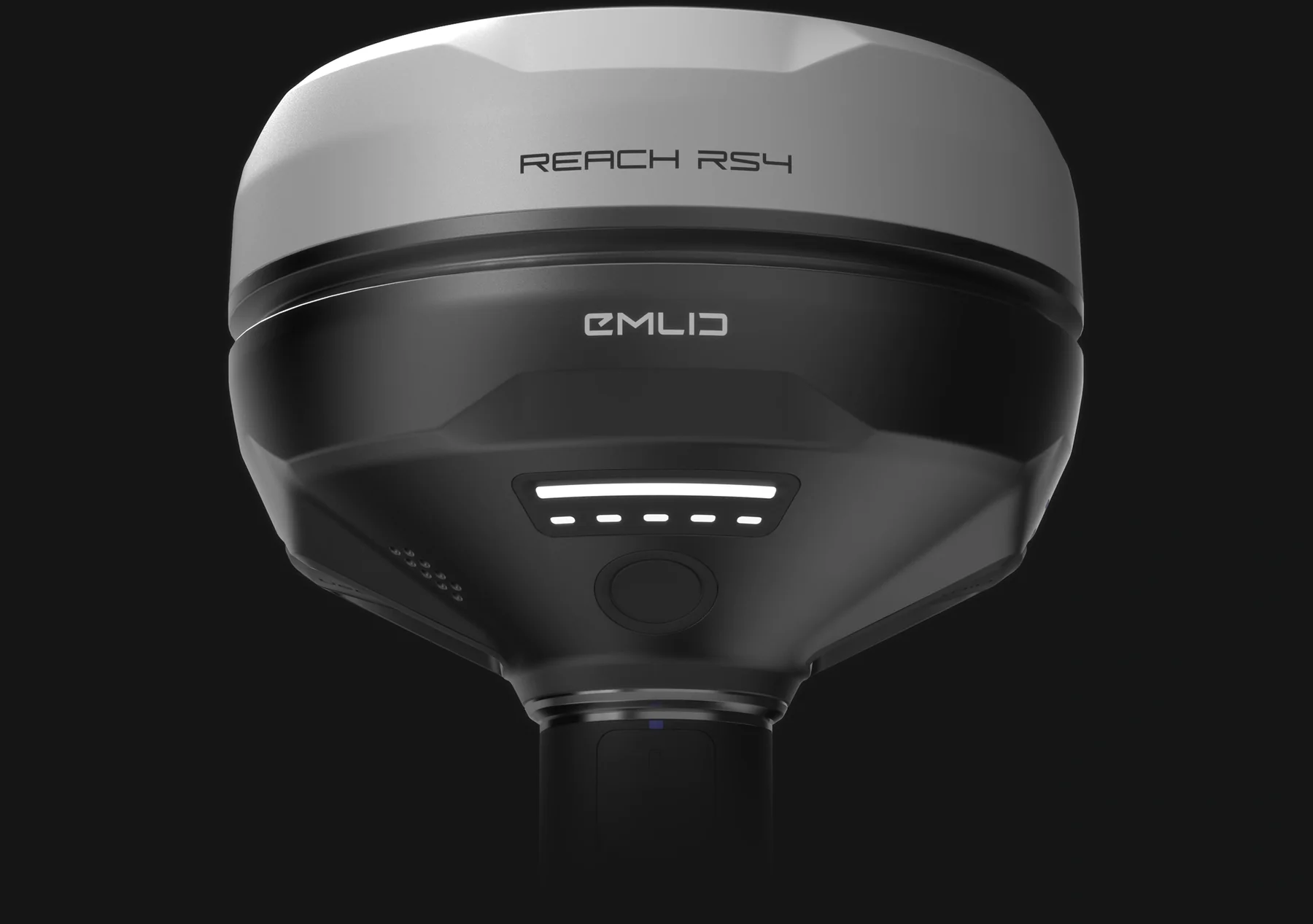
Emlid Reach RS4
A professional RTK GNSS receiver for teams requiring a more versatile field setup, including supported base-and-rover workflows.
- Suitable rover workflows
- Supported base-and-rover configuration
- Emlid Flow integration
- Field setup and training available
03 / Smartphone field software
Emlid Flow
Mobile field software for point collection, supported linework, coordinate management and stakeout.
- Coordinate and feature collection
- Supported measurement and stakeout workflows
- Project and export management
Singapore correction workflow
SiReNT Corrections
Singapore’s satellite-positioning reference network provides GNSS corrections for compatible RTK field workflows. Easepect can guide customers through configuration, coordinate settings and field verification, subject to service access and setup requirements.
Need to compare mobility, tilt and base/rover roles?
Use the detailed receiver guide before narrowing the engineer kit.
What Easepect provides
More Than a GNSS Receiver
Easepect helps construction companies implement a practical engineering measurement workflow around their people, existing design data and site responsibilities.
Equipment Selection
Recommend suitable Emlid RTK hardware according to the site environment, correction route and intended engineering tasks.
Initial Configuration
Assist with receiver setup, mobile application configuration and compatible correction services.
Singapore Coordinate Workflow
Guide the team in configuring SVY21 and the relevant vertical reference requirements for the project.
Practical Engineering Training
Train construction engineers to collect points, measure features, navigate to coordinates and export field data.
Quality-Control Procedures
Introduce repeatable field checks, control-point verification and measurement documentation.
Local Technical Support
Provide Singapore-based support for implementation, troubleshooting and workflow adoption.
Practical demonstration
See How Easy Construction Measurement Can Be
Let your engineers experience the complete workflow using an actual RTK receiver, a smartphone and realistic construction-site measurement tasks.
Connect
Connect an Emlid Reach RX2 to a smartphone and review the receiver and correction setup.
Collect
Collect the coordinate of a selected site feature using the agreed project settings.
Measure
Measure a distance between two observed points and review the field record.
Locate + Export
Import a predefined coordinate, locate it and export the field record for the engineering team.
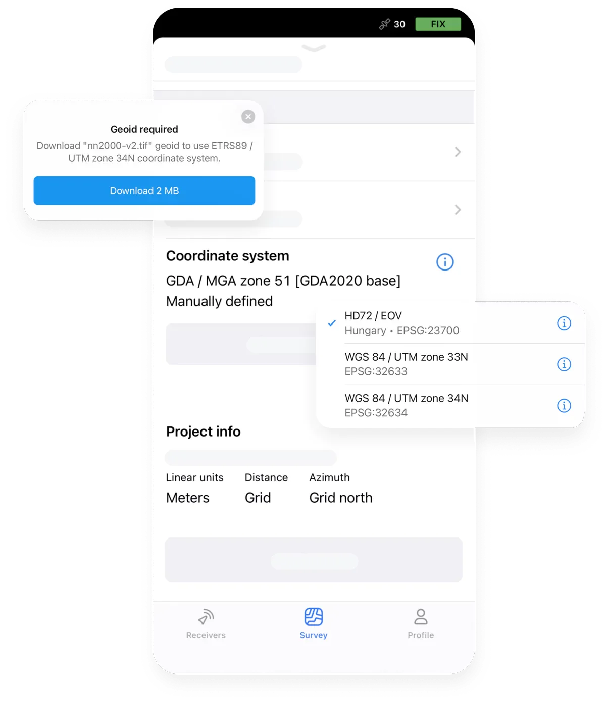
Connection, collection, measurement, design-point navigation and export—not just the receiver.
Official Emlid interface reference · Functions depend on version, subscription and configurationImportant technical boundaries
Practical Measurements with Responsible Quality Control
RTK GNSS can provide high-precision field positioning under suitable conditions. Measurement quality is site- and procedure-dependent; centimetre-level accuracy is not guaranteed for every site or environment.
Positioning status is not independent verification. Use the agreed control, observation routine and checks before relying on a measurement.
01
Satellite visibility and site obstructions
02
RTK correction availability
03
Receiver configuration
04
Correct antenna or pole height
05
Coordinate and vertical datum settings
06
Measurement procedures
07
Independent checks
Professional surveying responsibilities
Routine engineering measurement is not a substitute for regulated surveying.
Engineer-led RTK measurement supports routine documentation, preliminary positioning and suitable construction-engineering tasks. Where certification or survey supervision is required, the relevant qualified professional remains responsible.
- Registered Surveyor responsibilities
- Cadastral or legal boundary surveys
- Formal certified survey submissions
- Contractually required professional setting-out or as-built verification
- Other regulated surveying activities
Construction RTK FAQ
Practical answers for your engineering team.
Understand field collection, design-point navigation, coordinates, software and training before choosing an engineer RTK kit.
The demonstration covers the receiver, smartphone workflow, field checks and export as one connected process.
Yes, construction engineers can be trained to use RTK technology for appropriate routine field-measurement tasks. Formal surveys and professional sign-offs remain subject to applicable requirements.
Not necessarily. Emlid Flow provides a smartphone-based interface for supported collection and stakeout workflows. Available functions depend on the current software, subscription and configuration.
Yes, when the receiver, coordinate system and height reference are correctly configured. Elevation data must be checked against the required project datum; a GNSS ellipsoidal height is not automatically a project level.
Yes. Suitable field software can calculate measurements from collected points and geometries, subject to the available software features. Observation quality and independent checks remain necessary for the intended use.
Supported point coordinates and CAD information can be imported for applicable stakeout workflows. Confirm format, units and coordinate compatibility before use. Formal setting-out responsibilities and acceptance remain governed by the project specification.
Compatible Emlid RTK receivers can be configured to use suitable NTRIP correction services, including SiReNT, subject to subscription and setup requirements. Do not send NTRIP passwords or subscription tokens through the website enquiry form.
Performance may be degraded or unavailable where satellite reception is obstructed. Alternative measurement methods may be needed. No universal performance beside structures, under canopy or indoors is promised.
No. It allows your engineers to independently perform appropriate routine measurement tasks while retaining professional surveying support where required.
Yes. Easepect can provide practical onboarding covering receiver setup, coordinate configuration, field measurement, basic QA and data export. Training does not confer a statutory surveying qualification or guarantee project acceptance.
Equipment / demonstration / training
Give Your Engineers the Tools to Measure Independently
From a single engineer to a larger construction team, Easepect can help select suitable equipment, configure the system and provide hands-on training.
Do not submit sensitive site information through the general enquiry form. NTRIP passwords, subscription tokens and other credentials must not be requested or supplied here.