Singapore · Southeast Asia

See the application. Understand the evidence behind it.

Project references, pilots, demonstrations and research answer different questions. This library keeps those categories separate while connecting each application to its technical workflow and commercial next step.

Start with the operational problem.

These guides describe Easepect’s available service scope and method. They are not presented as named customer case studies.

01

Underground Utility GPC & GIS Deliverables

Document visible and exposed infrastructure before backfill, then move the spatial evidence into a controlled GIS handover without confusing reality capture with a complete underground utility survey.

02

Drone Mapping & Construction Progress Monitoring

Create a consistent aerial record of accessible construction areas, then compare agreed outputs across dates without treating visual change as automatic proof of progress, defects or compliance.

03

Scan-to-BIM & As-Built Verification

Turn observed building and asset geometry into a usable coordination package while keeping source evidence, model interpretation, design intent and acceptance decisions distinct.

04

RTK GNSS Survey Support

Establish a dependable positioning workflow around corrections, coordinate settings, observation quality and independent checks—not around a nominal accuracy number alone.

05

Industrial & Building Digital Twins

Build a digital representation around the operational decision: remote visual inspection, spatial review, asset context, historical comparison or facility-management handover.

06

Automated Drone Inspection & Monitoring

Standardise safe, repeatable collection of inspection evidence for accessible assets and sites, while keeping automation, observation, diagnosis and formal acceptance as separate responsibilities.

Education and technical knowledge sharing.

These entries describe the published activity and attribution—not a customer deployment or certification of Easepect.

EDUCATION / 2024

ITE–PIX4D learning-technology MOU

The NYAA Annual Report records an MOU between ITE and PIX4D, witnessed by ITE College East Principal Yek Tiew Ming and Kenneth Pan, Director of Easepect. It describes student use of PIX4D technology for 3D point-cloud models in landscape design.

Easepect was not the MOU signatory.
Read the annual-report entry
SEMINAR / 2025

ACES/IPAG reality-capture presentation

The published programme lists Kenneth Pan and the topic “Clouded by Point Cloud: Dehazing Reality Capture with PIX4D”, alongside a profile covering field operations, processing and geospatial adoption.

A professional seminar entry, not a project case study.
Open the official programme
CONFERENCE / 2026

SISV Singapore Geospatial

The conference programme lists Kenneth Pan / EASEPECT for “Fit-for-Purpose Accuracy: Handheld Photogrammetry with RTK Positioning for Utilities Mapping”.

A knowledge-sharing session, not a claim of regulatory acceptance.
View the conference programme

Training, knowledge sharing and research collaboration.

Supplied photographs document the activity context. These entries do not claim institutional endorsement, regulated acceptance or unverified project outcomes.

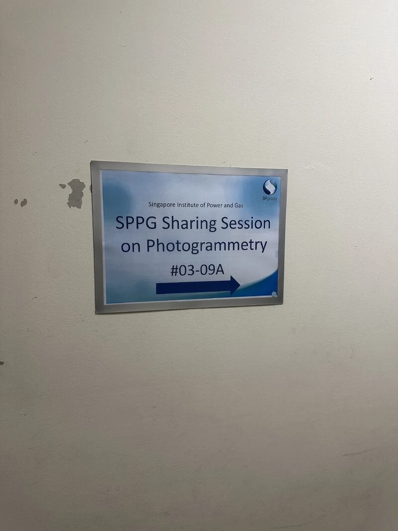
Directional sign for the SPPG Sharing Session on Photogrammetry at the Singapore Institute of Power and Gas
SPPG Sharing Session on Photogrammetry.

SPPG photogrammetry sharing session

Easepect, represented by Kenneth Pan, conducted a photogrammetry sharing session for SPPG, introducing practical image-based capture and spatial-data workflows.

A technical sharing session; no operational deployment or measured project outcome is claimed.Explore photogrammetry training
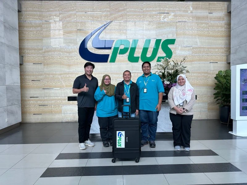
Kenneth Pan with PLUS Malaysia Berhad participants after photogrammetry and drone-mapping training
Photogrammetry and drone-mapping operations training with PLUS Malaysia Berhad.

PLUS Malaysia Berhad training

Easepect, represented by Kenneth Pan, conducted a training session for PLUS Malaysia Berhad on photogrammetry and drone-mapping operations.

A professional training activity; no certification, operational acceptance or institutional endorsement is implied.Explore professional training
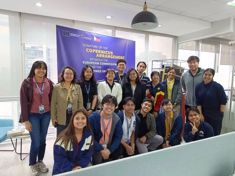
Kenneth Pan with Philippine Space Agency participants during a PIX4D training visit
PIX4D training with Philippine Space Agency participants.

Philippine Space Agency PIX4D training

Easepect, represented by Kenneth Pan, delivered PIX4D training to the Philippine Space Agency (PhilSA).

A professional training activity; no institutional endorsement or operational deployment is implied.Explore PIX4D solutions
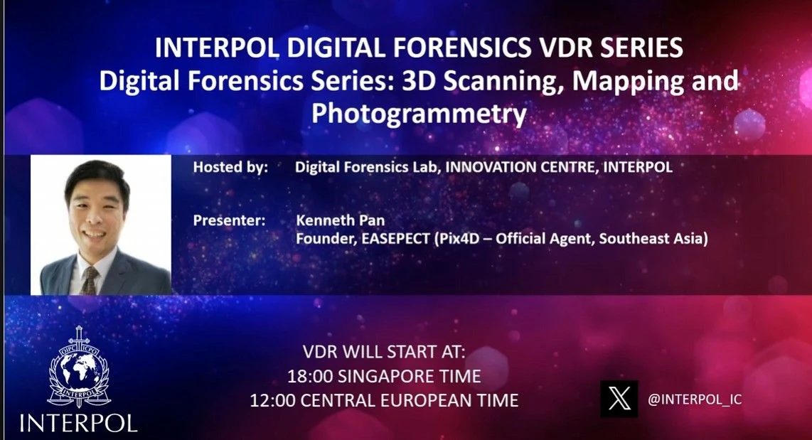
INTERPOL Digital Forensics VDR Series poster listing Kenneth Pan as presenter for 3D scanning, mapping and photogrammetry
INTERPOL Digital Forensics VDR Series presentation announcement.

INTERPOL Digital Forensics VDR Series

INTERPOL invited Easepect, represented by Kenneth Pan, to share photogrammetry knowledge for digital forensics through its Digital Forensics VDR Series on 3D scanning, mapping and photogrammetry.

A knowledge-sharing invitation; not a forensic accreditation, certification or INTERPOL endorsement.Explore photogrammetry workflows
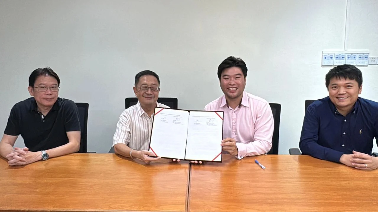
Participants holding the Bishan–Toa Payoh MOU for smart AI tree inspection using Living Optics hyperspectral camera technology
Bishan–Toa Payoh MOU for smart AI tree inspection using Living Optics hyperspectral imaging.
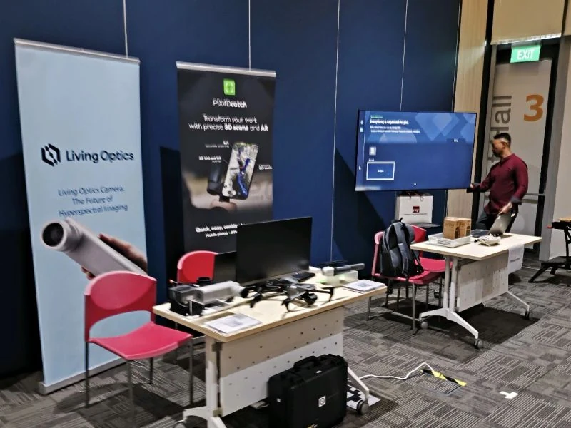
Demonstration table with Living Optics hyperspectral-imaging and PIX4Dcatch equipment
Supporting technology demonstration: Living Optics hyperspectral imaging and PIX4Dcatch.

Bishan–Toa Payoh smart-tree-inspection MOU

The Bishan–Toa Payoh MOU concerns smart AI tree inspection using Living Optics hyperspectral camera technology. Easepect was represented by Kenneth Pan.

The MOU records collaboration scope; it does not establish inspection accuracy, tree-safety diagnosis, deployment results or project acceptance.Discuss a technical demonstration

Explore Our Applications, Demonstrations and Industry Engagements

Discover how geospatial technologies are applied through practical demonstrations, technical engagements and real-world applications across Singapore's built environment. These definitions explain the categories used above; they are not project examples themselves.

01 / COMPLETED PROJECT

Commissioned Easepect delivery

A defined customer scope with completed fieldwork, processing or implementation. Reference details and outcomes are published only where supporting evidence and customer agreement exist.

02 / TRIAL / PILOT

Time-bounded technical evaluation

A controlled test of feasibility, compatibility or operating procedure. A pilot is not represented as a production deployment or an accepted customer result.

03 / DEMONSTRATION

Product or sample-data walkthrough

Manufacturer material, public datasets or representative exercises used to explain a workflow. Demonstrations are not Easepect customer projects.

04 / RESEARCH / KNOWLEDGE SHARING

Technical study or professional learning

A presentation, educational activity or investigation shared for professional development. This category does not imply a commercial installation or regulatory endorsement.

Explore Technology Applications and Demonstrations

Explore manufacturer-published cases, research and demonstration data, with the reference owner and source identified for each collection.

Relevant evidence, discussed responsibly.

Named customer work, site imagery and project outcomes require suitable evidence and customer agreement before they are published. For an evaluation, Easepect can instead discuss the relevant method, QA plan and non-sensitive demonstration material.

Request a relevant demonstration

Have a site or workflow that needs a controlled pilot?

Define the question, available evidence, users and acceptance criteria. We’ll help separate a useful trial from a production commitment.

Discuss your project