
SIRENT / COORDINATES + FIELD QA
RTK GNSS Surveying in Singapore — SiReNT, Base Stations and Emlid Workflows
RTK improves GNSS positioning by applying suitable correction data during observation. In Singapore, a compatible Emlid rover can use an appropriately subscribed SiReNT service or a correctly established independent base; neither route removes the need for coordinate control and independent checks.
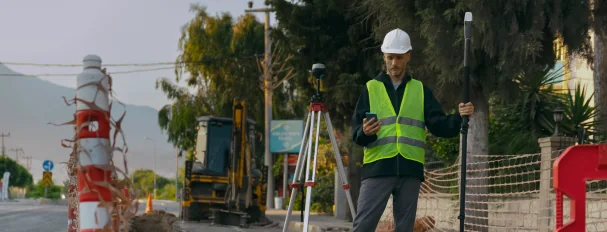
Observed data, configuration and quality evidence remain attached through handover.
01 / PRACTICAL OVERVIEW
Where RTK surveying in Singapore fits in the working system.
SiReNT is SLA’s Singapore Satellite Positioning Reference Network. Access requires an appropriate valid subscription and correct NTRIP credentials/token and configuration; an internet connection by itself is not sufficient. Users should follow SLA’s current service documentation and validate the setup on known control.
Coordinate handling is equally important. SVY21/Singapore TM projected eastings and northings are not interchangeable with WGS84 latitude and longitude. Height reference, geoid treatment and local project requirements must be agreed explicitly rather than assuming a receiver output already matches the drawing or GIS.
02 / CORRECTION ARCHITECTURE
Choose network RTK or an independent base by project conditions.
| Decision area | SiReNT / subscribed network | Independent base + radio/caster |
|---|---|---|
| Reference infrastructure | Provider-operated network under service terms | User-established compatible base |
| Access requirement | Valid subscription, credentials/token and mountpoint/profile | Base coordinate, correction output and compatible link |
| Field deployment | Rover and suitable internet connectivity | Base, rover, accessories and radio or internet/caster |
| Primary QA | Known-point validation, correction status and observation checks | Base-position verification plus the same rover checks |
| Potential fit | Mobile teams and sites with suitable coverage/service | Repeated controlled sites or projects requiring an independent reference |
03 / COORDINATE AND HEIGHT CONTROL
Write the reference definition into the field procedure.
- SVY21 / Singapore TM
- A projected horizontal coordinate system used in Singapore. Record units, eastings/northings and any transformation used for delivery.
- WGS84 geographic coordinates
- Latitude/longitude values are not SVY21 eastings/northings. Use a defined transformation and test the result against known control.
- Height reference
- GNSS ellipsoidal heights may require geoid or local vertical treatment. Agree the required height datum and verify against suitable benchmarks.
- Localisation and calibration
- If project localisation is used, document control distribution, residuals and valid extent. Do not conceal systematic mismatch through an unreviewed fit.
- Handover metadata
- Include CRS, height reference, correction profile, antenna height method, observation dates, quality evidence and exceptions with exports.
04 / FIELD QA/QC SEQUENCE
A fixed solution is the start of the check, not the end.
01 / Pre-mobilisation
Confirm subscription or base plan, firmware/software, mountpoint/profile, coordinate and height settings, equipment and site access.
02 / Known-point validation
Observe suitable known control before production. Investigate horizontal or vertical discrepancies before continuing.
03 / Production observation
Use appropriate occupation, tilt and coding procedures. Record solution status and correction interruptions; avoid hiding float or single observations.
04 / Closing and independent checks
Recheck control or independent points, review repeat observations and document discrepancies, exclusions and corrective action.
05 / Export review
Test coordinates, units, geometry and attributes in the target CAD/GIS environment before issuing the project record.
05 / SINGAPORE APPLICATIONS
Use RTK where the observation method fits.
Site benchmarks and check points
Establish or verify project reference points under an appropriate professional and observation methodology.
Construction and as-built measurement
Set out and record features with independent construction and survey QA, without assuming automatic acceptance.
Utility and GIS assets
Collect visible assets, lines and attributes with project codes and explicit vertical/horizontal references.
Photogrammetric control
Observe ground control and checkpoints for aerial or terrestrial reconstruction while keeping their survey evidence traceable.
06 / PROFESSIONAL BOUNDARY
Equipment does not determine regulatory acceptability.
A receiver and correction subscription do not automatically produce acceptable survey submissions. Survey methodology, professional assessment, applicable standards, contractual requirements and any regulated sign-off remain project responsibilities.
Easepect can support equipment configuration, technical demonstrations, workflow integration and training. NTRIP passwords and subscription tokens should be exchanged only through the approved operational process, never through the general website enquiry form.
07 / FREQUENTLY ASKED QUESTIONS
Before choosing RTK surveying in Singapore.
Compatible Reach rovers support NTRIP workflows and can be configured for an appropriate SiReNT service. A valid subscription, credentials/token and correct configuration are required, followed by known-point validation.
You need a correction source. This can be a subscribed network or your own compatible base. RX2 always needs an external source; RS4 Pro, RS4 and RS3 can also operate as bases.
The base remains at a reference location and generates correction observations. The rover moves to measurement points and applies those corrections. Some receivers can perform both roles; RX2 is rover-only.
No. WGS84 latitude/longitude and SVY21 projected eastings/northings are different coordinate representations. Define and verify any transformation rather than copying values between them.
No. Horizontal and vertical solution quality, base/reference height, antenna height, geoid or local height treatment and independent benchmark checks all affect the delivered height.
No. Project methodology, applicable standards, professional responsibility and acceptance criteria must be assessed separately from product capability.
LOCAL IMPLEMENTATION / SINGAPORE
Not sure which Emlid receiver suits your project?
Tell us what you are surveying, your operating environment and required deliverables. Model selection is optional; Easepect can help identify a suitable hardware and software workflow.