
UAV GNSS MODULE / RTK + PPK EVENTS
Emlid Reach M2 — GNSS Positioning and Camera Events for UAV Mapping
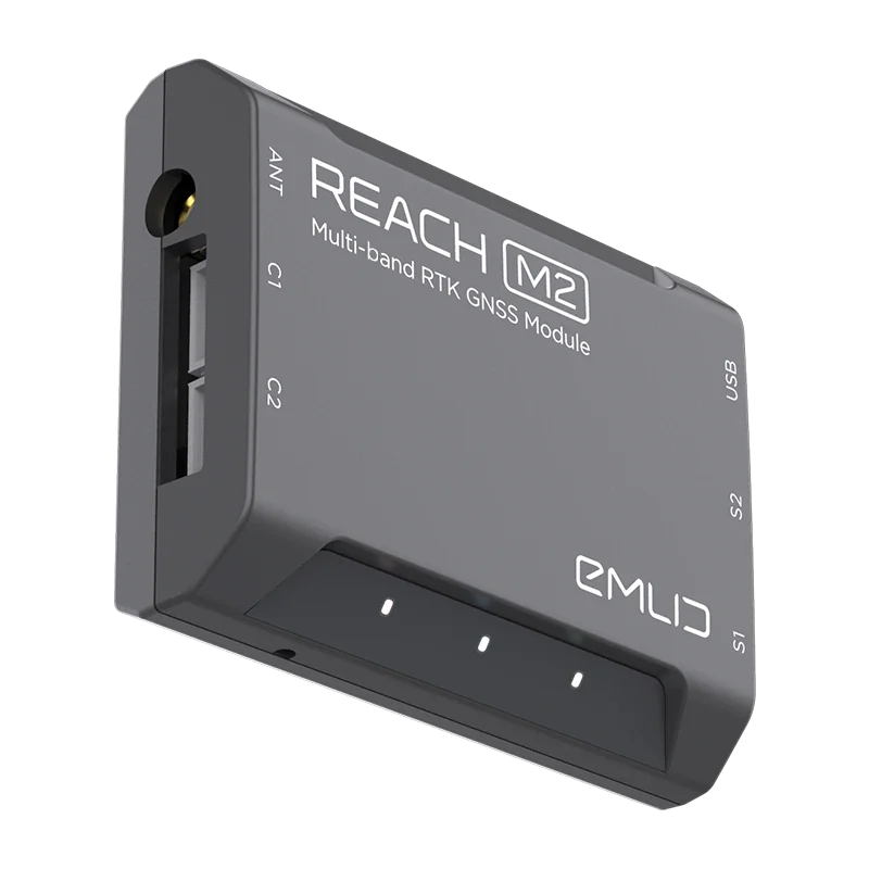
Reach M2 is a 35 g multi-band GNSS module for UAV integration, supporting RTK or PPK positioning, RINEX logging with camera events and position output for compatible systems. It is an onboard integration component, not a self-contained pole-survey receiver.
Observed data, configuration and quality evidence remain attached through handover.
01 / PRACTICAL OVERVIEW
Where Reach M2 for UAV integration fits in the working system.
M2 is intended for aircraft and navigation integrations where size, mass, power, antenna placement and electrical interfaces matter. For mapping, a camera hot-shoe or compatible event signal can associate image exposure timing with GNSS observations for subsequent geotagging.
Integration is an engineering task. Aircraft power, autopilot interfaces, antenna ground plane and placement, camera triggering, electromagnetic interference, cable routing and fail-safe behaviour must be assessed for the exact build. A module specification does not establish compatibility with every UAV or camera.
02 / TECHNICAL SPECIFICATION
Compact hardware with explicit interfaces.
- GNSS
- 184 channels; current documentation lists GPS/QZSS, GLONASS, BeiDou and Galileo multi-band signals.
- Dimensions and mass
- 56.4 × 45.3 × 14.6 mm; 35 g module weight. Antenna, cabling and integration hardware are additional design considerations.
- Logging and rate
- RINEX logging with events and GNSS update rates up to 10 Hz under the documented configuration.
- Corrections and output
- NTRIP/VRS/RTCM3 correction inputs and NMEA/LLH/XYZ position outputs for compatible integrations.
- Interfaces
- USB, UART and event interfaces, with documented power requirements. Camera hot-shoe accessories and antennas are scoped separately.
- Storage
- 16 GB internal storage listed in current manufacturer documentation.
03 / UAV MAPPING WORKFLOW
From exposure event to photogrammetric input.
01 / Engineer the installation
Confirm mechanical mounting, regulated power, antenna location, camera trigger, autopilot interface and aircraft electromagnetic compatibility.
02 / Test on the ground
Verify GNSS logging, base/reference logging, event registration and time synchronization before flight. Trigger test images and inspect the recorded events.
03 / Fly and retain the dataset
Keep base and rover logs, images, event/MRK information, antenna details and mission notes together under consistent naming.
04 / Process in Emlid Studio
Compute the event positions and geotag the matching images. Review solution coverage and event-to-photo counts before mapping.
05 / Reconstruct and check
Process imagery in suitable photogrammetry software and evaluate control, checkpoints, offsets and output quality.
04 / M2 OR A POLE-MOUNTED RECEIVER?
Different hardware for different roles.
| Requirement | Reach M2 | Reach RS4 / RS3 | Reach RX2 |
|---|---|---|---|
| Primary role | Onboard UAV/navigation module | Base and rover field surveying | Compact field rover |
| Integrated survey-pole housing | No | Yes | Yes |
| Camera-event integration | Supported event workflow | Not the primary purpose | Mobile-device integration rather than UAV hot-shoe role |
| RINEX logging | Yes, with events | Yes | Confirm current rover workflow and project need |
| Typical output use | Geotagged drone imagery and navigation positions | Survey features, base corrections and control | GIS features and supported mobile capture |
| Integration burden | Aircraft-specific engineering | Field kit and correction architecture | Correction source and mobile-device setup |
05 / COMPATIBILITY CHECKLIST
Resolve these items before procurement.
Aircraft and autopilot
Confirm electrical, UART/autopilot, mounting and firmware requirements for the exact aircraft rather than relying on a generic “compatible drone” statement.
Antenna and interference
Plan antenna type, cables, sky view, ground plane and separation from interference sources. Validate under operating conditions.
Camera and shutter events
Confirm hot-shoe or trigger signal, voltage/interface requirements and that each exposure creates one usable event.
Operations and compliance
Integration changes can affect aircraft mass, reliability and approvals. The module itself does not confer flight authorisation or regulatory acceptance.
06 / LOCAL SUPPORT
Prototype the integration before scaling it.
Easepect can scope the positioning, base/reference, event logging and photogrammetric processing route alongside your aircraft integration specialist. A ground-tested prototype and representative mapping dataset should precede fleet deployment.
Training should cover logs, event verification, Studio processing and downstream QA as well as field recovery when no events or incomplete observations are discovered after a mission.
07 / FREQUENTLY ASKED QUESTIONS
Before choosing Reach M2 for UAV integration.
No. M2 is an onboard GNSS module for UAV and navigation integrations. RS4 Pro, RS4, RX2 and RS3 are the primary field-receiver options presented in this microsite.
A compatible camera event or hot-shoe signal is recorded alongside GNSS observations. Post-processing associates corrected event positions with the matching images for geotagging.
Do not assume so. Power, antenna, physical integration, autopilot interfaces, camera triggering and electromagnetic compatibility are aircraft-specific and must be engineered and tested.
Not automatically. RTK/PPK image positioning can change the control strategy, but independent checkpoints and project-specific validation remain necessary.
Its documented role here is onboard RTK/PPK positioning and event logging. Use the RS4/RS3 family for conventional field base-station workflows rather than repurposing M2 as a pole base kit.
LOCAL IMPLEMENTATION / SINGAPORE
Not sure which Emlid receiver suits your project?
Tell us what you are surveying, your operating environment and required deliverables. Model selection is optional; Easepect can help identify a suitable hardware and software workflow.