TerraExplorer Fusion Introduction
A manufacturer introduction to accessing and interacting with 3D GIS projects in a web browser.
- Product
- TerraExplorer Fusion
- Industry
- Enterprise 3D GIS
 Get a quote
3D GIS / BROWSER
Browser-based access to terrain, 3D meshes, geospatial layers and analytical views without requiring every user to install a desktop GIS application.
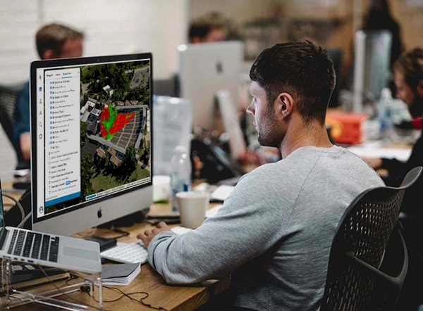
Source evidence, configuration and quality context remain attached through handover.
01 / PRACTICAL OVERVIEW
TerraExplorer Fusion supports broader access to 3D GIS projects through suitable browsers and operating systems. It is relevant to digital-twin portals, engineering collaboration, asset viewers and government GIS applications.
Browser delivery changes the client environment, not the need for managed data and permissions. The current family comparison distinguishes Viewer and Plus; server licensing can enable Plus capabilities for authorised projects.
OFFICIAL MANUFACTURER MEDIA
Skyline-hosted demonstrations and videos are manufacturer resources, not Easepect project references. Video players load only after selection.
A manufacturer introduction to accessing and interacting with 3D GIS projects in a web browser.
03 / BROWSER CAPABILITIES
Explore supported terrain, imagery, mesh, point-cloud, BIM and feature content.
Use edition-appropriate distance, area, profile, comparison and visibility functions.
Navigate spatial assets and associated layers in an interactive project.
Access published layers and projects with configured server permissions.
Available to suitably authorised Plus workflows rather than every viewer.
Use supported Fusion APIs and customisation options to build purpose-specific browser experiences.
04 / FUSION EDITIONS
| Capability area | Fusion Viewer | Fusion Plus |
|---|---|---|
| Core experience | Navigation, supported project viewing, measurement and documented analysis | Includes Viewer capabilities |
| Advanced analysis | Documented tools such as comparison, profile, slope and viewshed | Adds Photo Inspector, viewshed query, cross-section and other documented tools |
| Layer access | View content made available in the project | Load and style supported SkylineGlobe Server layer types |
| Editing and drawing | Limited project interaction | Basic drawing and authorised feature-layer editing |
| Publishing | Not the general publishing edition | Authorised users can publish supported content to SkylineGlobe Server |
05 / COMMERCIAL APPLICATIONS
Provide managed access to current spatial content.
Give reviewers a common geographic view without desktop deployment for every user.
Support asset review with appropriate analysis and permissions.
Separate public project access from restricted internal information.
06 / FREQUENTLY ASKED QUESTIONS
Yes. Fusion provides 3D GIS access through supported web browsers without a desktop application installation. Project content, server configuration, browser compatibility and edition determine the available tools.
LOCAL IMPLEMENTATION / SINGAPORE
Share your application, approximate data volume and user responsibilities. Easepect can help scope product supply, demonstrations, deployment, integration and training.