TerraExplorer Overview
An introduction to navigating and investigating geospatial content in TerraExplorer.
- Product
- TerraExplorer Desktop
- Industry
- 3D GIS
 Get a quote
3D GIS / DESKTOP
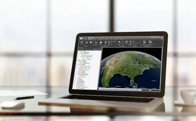
A professional 3D GIS environment for combining terrain, imagery, point clouds, meshes and GIS information, with edition-dependent tools for analysis, editing, conversion and publishing.
Source evidence, configuration and quality context remain attached through handover.
01 / PRACTICAL OVERVIEW
TerraExplorer Desktop allows users to investigate physical environments and infrastructure in three dimensions. It can bring together reality-capture outputs, geospatial layers and supported design information for engineering review and stakeholder communication.
The three desktop editions do not provide identical functionality. Viewing and terrain analysis, advanced editing and API work, and publishing or conversion responsibilities should be mapped to the correct edition before procurement.
OFFICIAL MANUFACTURER MEDIA
Skyline-hosted demonstrations and videos are manufacturer resources, not Easepect project references. Video players load only after selection.
An introduction to navigating and investigating geospatial content in TerraExplorer.
A manufacturer demonstration of spatial comparison tools for reviewing different project conditions.
Explore how a PhotoMesh model and associated source photographs can support visual inspection.
03 / CORE CAPABILITIES
Navigate terrain, 3D meshes, point clouds and geospatial layers in an interactive environment.
Use supported distance, area, elevation and volume tools within the limits of the data and edition.
Investigate slope, profiles, visibility and line of sight with appropriate tools.
Compare survey epochs or model conditions while retaining source and coordinate context.
Overlay geographic features and attributes; querying and editing depend on edition.
Where supported, inspect mesh locations alongside source photography and record observations.
Combine supported BIM and GIS content following the necessary conversion and georeferencing workflow.
Prepare guided geospatial presentations for technical review and stakeholder communication.
04 / DESKTOP EDITIONS
| Edition | Documented role | Important boundary |
|---|---|---|
| Viewer | Navigation, online and selected offline content, measurement and advanced terrain analysis; basic editing | Do not assume all offline formats, feature editing, conversion or publishing are included |
| Plus | Adds all documented offline formats, feature editing/querying, advanced drawing, professional tools and Pro API interfaces | Publishing and advanced conversion are not the defining additions of Plus |
| Pro | Adds publishing, cloud upload, advanced conversion and model optimisation capabilities | Confirm required output and server permissions for the intended publishing workflow |
05 / EXTENDED WORKFLOWS
06 / FREQUENTLY ASKED QUESTIONS
Viewer focuses on navigation, visualisation and analysis with basic editing. Plus adds broader offline loading, feature editing and querying, advanced tools and Pro API interfaces. Pro adds publishing, cloud upload and advanced conversion/optimisation. Use Skyline’s current comparison table for feature-level checks.
Yes, documented comparison tools support suitable model and layer comparisons. A visible difference still needs coordinate alignment, source-quality review and professional interpretation before it becomes an engineering conclusion.
Yes. TerraExplorer supports suitable BIM, CAD, GIS, terrain, mesh and point-cloud content, subject to formats, conversion and edition. Georeferencing and attribute handling should be tested with representative project data.
LOCAL IMPLEMENTATION / SINGAPORE
Share your application, approximate data volume and user responsibilities. Easepect can help scope product supply, demonstrations, deployment, integration and training.