SLA is using our solution.
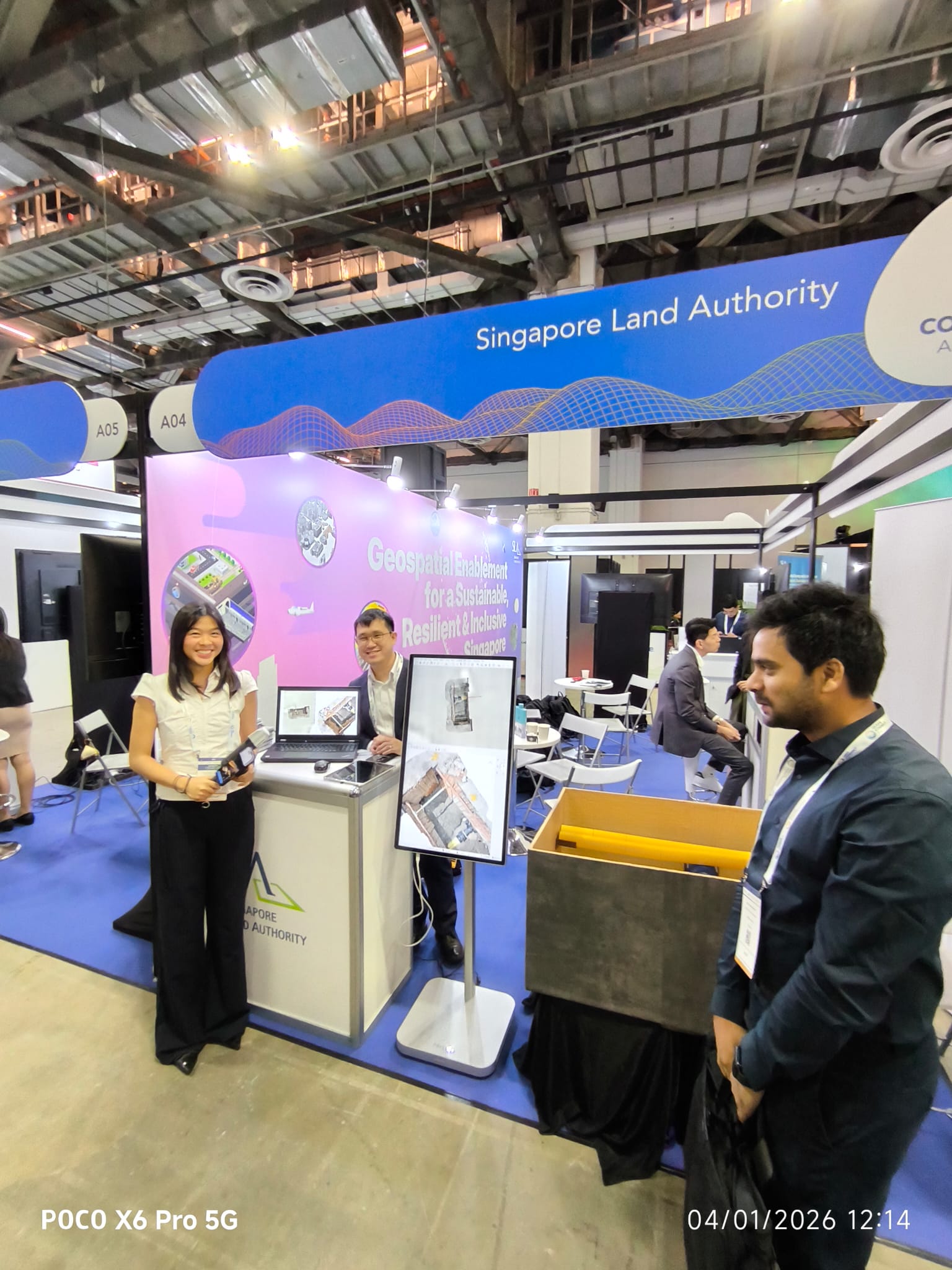
The Singapore Land Authority adopted the Easepect PIX4Dcatch + Emlid RTK trench-scan methodology for subsurface utility documentation — now in production, with our team featured at the SLA Geospatial Enablement showcase.
A production methodology — not a demo.
Easepect was invited to exhibit alongside the Singapore Land Authority under the Geospatial Enablement for a Sustainable, Resilient & Inclusive Singapore banner. The exhibit demonstrated the PIX4Dcatch + Emlid RTK trench-scan workflow that SLA has adopted in production for subsurface utility documentation — the methodology that produces ASCE 38 / PAS 128 QL-A as-built records from a smartphone-class capture device.
The workflow allows site engineers (rather than on-call surveyors) to capture every visible utility before the trench is closed. Easepect supplies the PIX4Dcatch and Pix4Dcloud licences, the Emlid Reach RX RTK rover, the SiReNT corrections setup, the operator training and the final deliverable sign-off in partnership with licensed surveyors.
Absolute 3D, RTK-fixed.
ASCE 38 / PAS 128 evidence.
No call-out crew needed.
The capture stack.
PIX4Dcatch
iOS app on a LiDAR-equipped iPhone Pro / iPad Pro. Photogrammetry + LiDAR fusion captures every visible pipe, joint and connection in 3D before the trench is backfilled.
Emlid Reach RX
7 mm + 1 ppm RTK rover paired over Bluetooth, fed with SiReNT NTRIP corrections. Drives the absolute geolocation of every captured frame.
PIX4Dcloud + Survey
Cloud processing produces the georeferenced point cloud and orthophoto. PIX4Dsurvey vectorises the network into Shapefile / DXF / IFC for direct ingestion into the SLA GIS.
What changed for the agency.
- ✓Site-team capture. Field engineers run the scan — no waiting on a survey call-out.
- ✓QL-A evidence. Sub-5 cm absolute, with surveyor sign-off built into the deliverable chain.
- ✓Faster than total-station survey. Trench documentation in minutes, not hours.
- ✓Lower call-out cost. Surveyor reviews the deliverable rather than attending every visit.
- ✓Strike avoidance. Geo-accurate as-builts make future excavations safer.
- ✓AR overlay. Crews can re-project the buried network on subsequent visits.
The full Easepect engagement.
Hardware & software
- · iPhone Pro with PIX4Dcatch licence
- · Emlid Reach RX RTK rover
- · PIX4Dcloud + PIX4Dsurvey licences
- · SiReNT NTRIP credentials and configuration
- · Custom Pix4D Autotag set for the SLA programme
Services
- · Two-day operator training in Singapore
- · On-site walk-through with the SLA capture team
- · Per-vertical playbook for utility documentation
- · Surveyor partnership for sign-off chain
- · Tier-1 in-region support throughout the programme
Behind the methodology.
For the full methodology — the workflow, the stack, the standards alignment and the FAQ — read /solutions/subsurface-mapping/. For tutorials and accuracy benchmarks on the underlying technique, visit our companion knowledge site photogrammetry.com.sg.
Run the same methodology on your next utility programme.
Easepect ships the kit, runs the training and configures SiReNT corrections — typically inside a fortnight.