
Asset owners, inspectors and operations teams planning repeatable visual or spatial evidence collection.
SERVICES / REPEAT MISSIONS + INSPECTION EVIDENCE
Automated Drone Inspection & Monitoring
Standardise safe, repeatable collection of inspection evidence for accessible assets and sites, while keeping automation, observation, diagnosis and formal acceptance as separate responsibilities.
Project scope, measured performance and acceptance criteria are confirmed for each appointment.
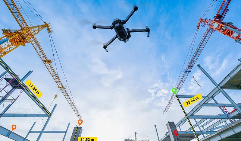
A mission and sensor definition, dated inspection evidence, comparison views, an observation register and operational QA.
List the assets, target views, inspection interval, operating constraints and who is responsible for technical conclusions.
Request a contextual quotation01 / CUSTOMER PROBLEM
Understanding Your Project Requirements
Repeat inspections can produce inconsistent imagery when viewpoints, routes, camera settings and observation records vary between visits. Manual review also becomes difficult when files are not tied to assets, dates and areas of interest.
A controlled monitoring workflow can repeat agreed routes and viewpoints, organise evidence and flag changes for inspection. It does not make every flight autonomous, eliminate the operator, or turn image change into a confirmed defect.
02 / EASEPECT’S SCOPE
Our Services and Deliverables
Develop repeatable routes, viewpoints and evidence-handling procedures for the assets and visible conditions your inspectors need to review.
Inspection-question definition
Identify assets, visible conditions, areas of interest, review responsibilities and the evidence needed for each inspection cycle.
Site and operating assessment
Evaluate access, obstacles, GPS and communication conditions, safety, aviation requirements, security and weather constraints.
Mission and sensor design
Define repeatable routes or viewpoints, camera and sensor suitability, safe standoff and required image or spatial detail.
Capture and data management
Collect approved data with consistent mission, asset, date and exception records under the agreed operational control.
Review and escalation
Organise current and historical evidence, document observations and route uncertain findings to the responsible inspector or engineer.
03 / TECHNICAL WORKFLOW
How We Deliver Your Project
A feasible baseline is established first, followed by supervised repeat capture, organised comparison and escalation of observations to the responsible reviewer.
- 01
Define the inspection scope
List assets, target conditions, required views, reporting format and who is responsible for technical conclusions.
- 02
Assess feasibility
Confirm site access, operational approvals, environmental limits and whether a repeatable automated route is safe and useful.
- 03
Establish the baseline
Record approved viewpoints, flight or capture parameters, sensor settings and reference condition without claiming defect completeness.
- 04
Run controlled repeat capture
Execute the agreed mission under active operational supervision, record interruptions and inspect coverage before completion.
- 05
Process and compare
Produce agreed imagery, maps or models and compare consistent views or spatial outputs across dates.
- 06
Review and issue
Provide dated evidence and observations with limitations; responsible professionals determine defects, risk and required action.
04 / HARDWARE + SOFTWARE
Technology and Equipment
Aircraft, sensors, mission tools and review software are selected around asset access, target detail, positioning and operating constraints.
PIX4Dcatch
Ground or close-range mobile capture can complement aerial views where visible details and access make it suitable.
PIX4Dmatic & PIX4Dcloud
Local reconstruction and optional approved online review for supported inspection and mapping outputs.
Skyline PhotoMesh & TerraExplorer
3D production and spatial review for suitable assets, sites and historical comparison workflows.
MicaSense
Multispectral or thermal sensors can address specific environmental questions; anomalies require validation and do not independently diagnose a cause.
Emlid Reach M2
UAV positioning and event workflows can be assessed for compatible mapping integrations.
05 / DELIVERABLES
Project Deliverables
Receive dated imagery or spatial outputs, consistent comparison views, an observation register and operational notes for each agreed inspection cycle.
Repeatable mission definition
Agreed routes or viewpoints, capture parameters, operating constraints and a documented baseline.
Dated inspection evidence
Organised imagery, maps or models tied to the agreed assets, dates and areas of interest.
Comparison views
Current and historical evidence arranged for review of visible change, with inconsistent coverage identified.
Observation register
Agreed observations, locations, evidence references and escalation status; conclusions remain with the responsible reviewer.
Operational QA record
Mission interruptions, weather, coverage gaps, image-quality issues and processing exceptions.
06 / QA + QC
Accuracy Checks and Quality Assurance
Target viewpoints, image detail, coverage and comparability are checked before observations are interpreted or escalated.
- Mission coverage and target viewpoints checked after capture
- Image detail, sharpness and exposure reviewed for the intended observation
- Repeat views assessed for comparability before change interpretation
- Sensor limitations and environmental conditions recorded
- Observations separated from diagnosis, risk classification and acceptance
- Operational permissions and safety responsibilities confirmed for each deployment
07 / EXCLUSIONS + RESPONSIBILITIES
Project Scope and Exclusions
Autonomy, aviation permissions, hidden conditions and defect diagnosis are not assumed; the responsible inspector retains technical conclusions and acceptance.
- Unrestricted autonomous flight, beyond-visual-line-of-sight operation or regulatory approval
- Complete detection of all defects, including hidden or internal conditions
- Automatic structural, safety, leak, disease or compliance diagnosis
- Thermal imagery as direct soil-moisture measurement or definitive pipe-leak detection
- Operations in unsafe weather, airspace, access or site conditions
08 / FREQUENTLY ASKED QUESTIONS
Practical answers before you request a quotation.
Not necessarily. Repeatable mission elements can be automated where suitable, but operational control, site constraints, safety and aviation requirements remain project-specific.
No. Change detection identifies differences for review. Lighting, viewpoint, occlusion and site activity can create differences, and a confirmed defect requires appropriate technical assessment.
No. Thermal patterns may support a specific investigation under suitable conditions, but they are not direct proof of a pipe leak or its cause. Confirmatory methods remain necessary.
A spectral anomaly does not independently diagnose disease, nutrients, water stress or tree safety. Ground validation and qualified interpretation are required.
It can reduce or target some access needs, but hidden conditions, close examination, testing and statutory inspection may still require physical attendance and appointed professionals.
PROJECT / DEMONSTRATION
Request a Project Quotation
List the asset types, target views and preferred inspection interval. We will assess a safe, repeatable capture and evidence-review programme with your team.