
PIX4Dcatch Mobile Photogrammetry and RTK Scanning

PIX4Dcatch is a mobile reality-capture application that turns overlapping smartphone or tablet imagery—and supported device LiDAR—into 3D site records. With a compatible RTK receiver on iOS, images can be geotagged using corrected GNSS positions for downstream georeferenced processing.

Technical content reviewed against official sources · 16 November 2026
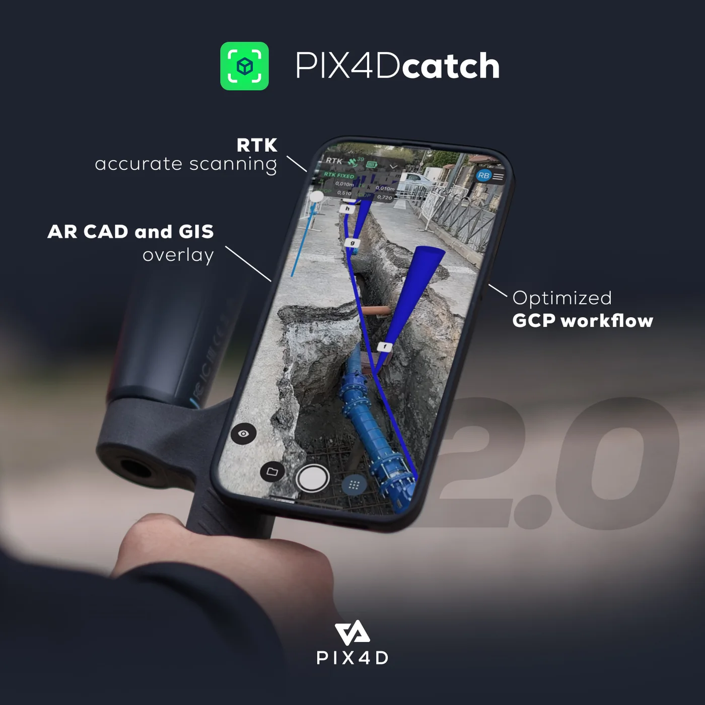
PIX4Dcatch mobile reality-capture application and spatial capture workflow.
PIX4Dcatch official product visual. Official manufacturer reference image.
WORKFLOW ARCHITECTURE01 — 04
01VISIBLE SURFACES
02IMAGES + RTK
033D RECORD
04CHECKED HANDOVER

Observed data and quality evidence remain attached through handover.

Where PIX4Dcatch fits in the working system.

PIX4Dcatch is used when a team needs close-range spatial documentation without setting up a full terrestrial laser-scanning workflow. Typical subjects include exposed utilities, small structures, civil details and accessible site features. The operator moves around the subject while the app captures images and device data; processing then reconstructs geometry and visual context.

Its value is not “survey grade from a phone” as a blanket claim. A useful result depends on visible surfaces, capture geometry, lighting, occlusion, device support, RTK correction quality, coordinate handling, processing and independent checks. Easepect configures the complete route—from receiver and correction service to processing, QA and handover—around the required evidence.

See PIX4Dcatch in Action — From Smartphone Capture to 3D Reality

Discover how PIX4Dcatch transforms a compatible smartphone into a mobile reality-capture tool. Combined with a supported RTK GNSS receiver, PIX4Dcatch enables users to capture georeferenced site imagery and process it into detailed 3D models and point clouds.

Whether documenting exposed underground utilities, inspecting construction works or recording site conditions, PIX4Dcatch provides a practical approach to collecting spatial information.

Technical resources reviewed by Easepect Technologies · 16 November 2026. Video and demonstration data are supplied by PIX4D and are not presented as Easepect project references. Video facade images are official PIX4D workflow illustrations, not frames from the videos.

Don’t Just Watch — Explore the 3D Results

Open actual PIX4D-hosted demonstration datasets in a new browser tab. Availability, navigation tools and browser performance are managed by the manufacturer platform.

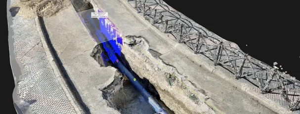
PIX4Dcatch mobile 3D scanning for underground utility trench documentation

Underground Utilities and Trench Documentation

Explore a digital representation of underground utility infrastructure captured for spatial documentation. Inspect the 3D scene, understand the utility arrangement and discover how georeferenced reality capture supports infrastructure records.

Explore Utility Trench in 3D
PIX4Dcatch construction verification and earthworks documentation workflow

Construction Verification and Earthworks

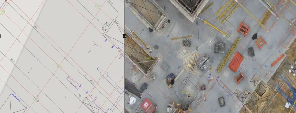
Explore how reality capture can support construction documentation, earthworks assessment, volumetric analysis and site verification. Any measurement remains dependent on the reconstruction, coordinate handling and project-specific QA.

Explore Construction 3D Model
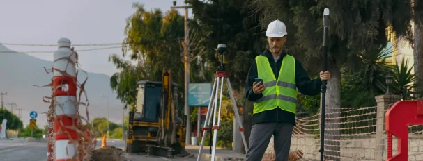
PIX4Dcatch civil engineering and land-surveying capture workflow

Civil Engineering and Site Verification

Review how a captured site can be represented digitally to support engineering coordination, documentation and comparison against design information. Design overlays and acceptance decisions require separately validated references.

View Civil Engineering Project

Interactive demonstration data hosted by PIX4D. These examples are not presented as Easepect project references. Workflow images are official PIX4D illustrations, not screenshots of the linked datasets.

From First Capture to Survey-Ready Deliverables

Start with capture, RTK configuration and cloud transfer. Continue into point measurement, coordinate reference systems and field-quality decisions when your team is ready.

Capture Your First 3D Model

Follow the field sequence for a first capture: define the visible subject, move with consistent overlap and review coverage before leaving the site. A complete image set remains more important than a visually impressive live preview.

Watch on YouTube

Set Up an RTK Profile

Understand the receiver, correction-service and coordinate settings behind an RTK profile. Validate the complete configuration at a known point; an RTK-fixed status alone does not verify offsets, datums or reconstructed geometry.

Watch on YouTube

Upload Your Capture to PIX4Dcloud

See the transfer route from a mobile project to cloud processing and review. Before uploading operational site data, confirm the current plan, project access, retention requirements and whether external hosting is permitted.

Watch on YouTube
More Tutorials3 additional official videos

Measure Points with PIX4Dcatch

Learn how supported RTK workflows can be used for point observations and field documentation. Keep these measurements distinct from reconstructed point-cloud geometry and apply independent checks where the result informs acceptance.

Watch on YouTube

Understanding Coordinate Reference Systems

Review why correction-input coordinates, project coordinates and delivery coordinates must be defined explicitly. WGS84 latitude and longitude are not interchangeable with SVY21 eastings and northings, and height references need separate attention.

Watch on YouTube

Best Practices for 3D Capture

Improve reconstruction conditions through deliberate movement, overlap, lighting and surface coverage. Record occlusions and inaccessible areas as limitations rather than allowing processing to imply detail that was never observed.

Watch on YouTube

Need a topic not covered here? Use the manufacturer’s current tutorial index and confirm instructions against your app version, device and plan.

Open the complete PIX4Dcatch tutorial catalogue

Capture Geo-Located Point Clouds Without a Traditional Laser Scanner

For suitable projects, close-range photogrammetry combined with RTK positioning provides a practical alternative to laser scanning for documenting visible site conditions.

  1. 01

    Capture exposed utilities

    Use PIX4Dcatch on a compatible mobile device to record visible surfaces with suitable overlap and coverage.

  2. 02

    Connect supported RTK

    Connect a supported Emlid RTK GNSS receiver where applicable, using a compatible iOS workflow.

  3. 03

    Define survey references

    Apply suitable positioning, coordinate reference systems, height treatment and known-point checks.

  4. 04

    Process the imagery

    Use PIX4Dmatic or PIX4Dcloud according to dataset support, governance and the selected plan.

  5. 05

    Generate spatial records

    Create a georeferenced 3D model and geo-located point cloud from the captured evidence.

  6. 06

    Interpret visible features

    Identify and vectorise exposed utility features while keeping interpretation distinct from observed geometry.

  7. 07

    Export project outputs

    Prepare suitable vector or GIS deliverables, including SHP where supported by the downstream workflow.

  8. 08

    Verify before issue

    Carry out project-specific accuracy verification and QA/QC before submission or operational use.

Photogrammetry records exposed infrastructure. It does not detect pipes through soil.

Close-range photogrammetry documents visible or exposed underground infrastructure. For Singapore projects, GPC can supplement required utility surveys and records under the applicable URA IPAG framework; generating a point cloud does not automatically satisfy regulatory, project, certification or acceptance requirements.

Bring us the utility record you need to produce.

We can help assess visibility, positioning, processing, GIS interpretation and project-specific QA without assuming that one application replaces every required survey method.

Discuss Your Utility GPC Workflow with Easepect

What the implementation should improve.

01

Capture before concealment

Record exposed pipes, connections, chambers and trench context during the site window before backfill removes direct visibility.

02

Keep field deployment compact

Use a supported mobile device and compatible RTK rover where the subject, access and evidence requirements suit close-range photogrammetry.

03

Choose the processing route

Transfer projects into PIX4Dmatic for desktop control or PIX4Dcloud for online processing and collaborative review, subject to plan and dataset support.

04

Retain quality evidence

Review capture-quality information, coordinate settings and independent checkpoints rather than treating point density or an RTK-fixed label as proof of accuracy.

Current capabilities and constraints.

Specifications summarise official manufacturer documentation reviewed on 16 November 2026. Exact support remains version-, device-, sensor- and plan-dependent.

Platforms
iOS and Android applications; feature support differs by platform, app version and mobile device.
Device LiDAR
Available on compatible LiDAR-equipped iOS devices. Android does not support the LiDAR capture workflow.
RTK connection
Supported RTK rovers on iOS. Current PIX4D documentation lists Emlid Reach RX/RX2, Bad Elf Flex/Flex Mini, Leica FLX100 plus, Topcon HiPer CR, Trimble Catalyst DA2 and supported viDoc configurations.
Android RTK limitation
RTK receiver connections are not supported on Android from version 1.28.0; GPS-only capture remains available.
Corrections
NTRIP-delivered RTK corrections require an appropriate correction source and service coverage. Camera offset, coordinate reference system and datum configuration must be checked.
Processing
PIX4Dcloud or PIX4Dmatic, including OPF-based transfer where supported. Available processing options depend on the destination product and plan.
Local exports
Project ZIP and PLY point cloud on iOS and Android. OBJ mesh, GLTF dense point cloud and several extended export functions are iOS-specific in the current comparison.
AR functions
Selected iOS workflows support AR points, project visualisation and design context. AR alignment must not be treated as independent verification of construction or survey accuracy.

Use it where the evidence fits.

01

Exposed utility GPC

Georeferenced visible geometry and imagery for trench, duct, pipe and chamber records before reinstatement.

02

Close-range as-built records

Accessible small structures, installations and civil details where overlapping views can cover the required surfaces.

03

Condition documentation

Repeatable visual records of facades, components or work areas, with limitations and capture dates documented.

04

Field design context

Supported AR review of points or models for orientation and communication, with critical dimensions checked by appropriate methods.

From configuration to accepted handover.

A usable deployment defines QA and output responsibility before field capture or processing begins.

01 / Define evidence

Confirm visible assets, required outputs, coordinate system, height reference, capture window and acceptance checks.

02 / Configure

Verify device support, app version, RTK mounting and offsets, NTRIP profile, correction input CRS and output CRS.

03 / Capture

Move steadily around exposed surfaces with strong overlap. Cover connections and terminations, avoid motion blur and record occlusions or unsafe access limits.

04 / Process

Export or upload to the selected processing environment. Review reconstruction completeness and any camera or georeferencing warnings.

05 / Verify & deliver

Compare independent checkpoints and known dimensions where appropriate. Deliver spatial files, metadata, source evidence and exceptions under the agreed scope.

Plan every interface.

Emlid Reach RX2

A supported RTK rover for PIX4Dcatch on iOS. RS-series receivers can serve as base stations in suitable NTRIP configurations but are not direct PIX4Dcatch rovers.

PIX4Dmatic

Use supported project exports for local photogrammetric processing, inspection and downstream survey workflows according to the licence tier.

PIX4Dcloud

Upload supported projects for cloud reconstruction, visualisation, measurements, annotations and sharing according to plan.

CAD / GIS handover

Export route and format are chosen for the recipient system. Observed point geometry remains distinct from interpreted utility features and certified drawings.

Outputs that can move into project use.

Plan-specific and optional functions are identified. Project QA and certified outputs are not implied by the software licence.

Source project

Captured imagery and associated project data, subject to export method and platform.

Spatial geometry

Point cloud and mesh outputs through supported local or processed export routes; formats vary by platform and destination.

Georeferencing metadata

Coordinate reference information, RTK details and processing quality information where generated.

Project QA package

Easepect-scoped checkpoint results, coverage exceptions and handover notes; this is a project service, not an automatic app output.

Select by required work, not product hierarchy.

PIX4Dcatch workflow comparison
MethodBest fitKey dependency
PIX4Dcatch photogrammetryVisible, texture-rich close-range assets and rapid field documentationCoverage, lighting, surface texture, georeferencing and processing
Device LiDAR-assisted captureSupported iOS devices where direct depth assists reconstructionDevice support, range, occlusions and subsequent QA
Laser scanning / SLAMBuilt-environment geometry or projects requiring a scanner-based evidence routeLine of sight, trajectory or registration, control and surface response
GNSS point observationsControl, checkpoints and discrete surveyed featuresCorrection quality, observation method and datum handling

Local coordinates, operating conditions and support.

01

SVY21 and height

Agree the project coordinate reference system and height datum before capture. Record transformations rather than assuming a correction service output equals the required delivery reference.

02

Correction service

Confirm NTRIP account, mountpoint, mobile connectivity and site coverage. A self-hosted base can be considered where appropriate, but configuration and known-coordinate responsibility remain.

03

Backfill coordination

Plan capture around actual exposure windows and safe access. Incomplete areas are recorded as exceptions, not reconstructed by assumption.

04

Local implementation

Easepect can combine compatible equipment, field configuration, a representative GPC exercise, processing setup and team training.

Before choosing PIX4Dcatch.

PIX4Dcatch is a mobile reality-capture application for collecting overlapping site imagery and supported device data for 3D reconstruction. Feature support varies by app version, mobile operating system, device and plan.

Specify the working system, not only the licence.

Share your source data, required outputs, users and constraints. Easepect can scope product supply, a technical demonstration, implementation and training.