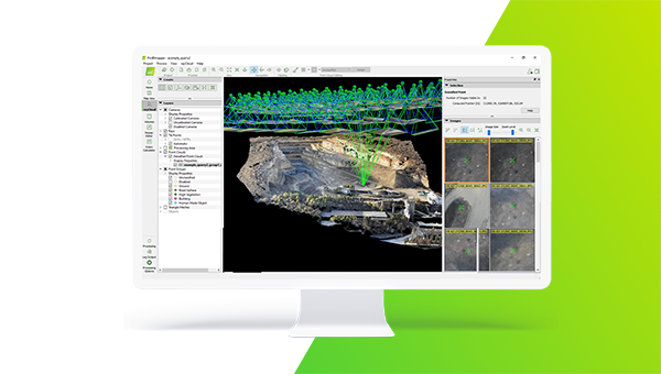
Flexible Plans & Pricing

Software and hardware solutions to digitize reality beyond photogrammetry and enable you to achieve your goals in every stage of work

buy Pix4DmapperPIX4Dmapper

The most comprehensive photogrammetry software taking you from images to the 2D or 3D outputs you need.

Transform your images into survey-grade accurate and georeferenced orthomosaics, points clouds, 2D maps, and 3D models for analysis, inspections, and measurements.
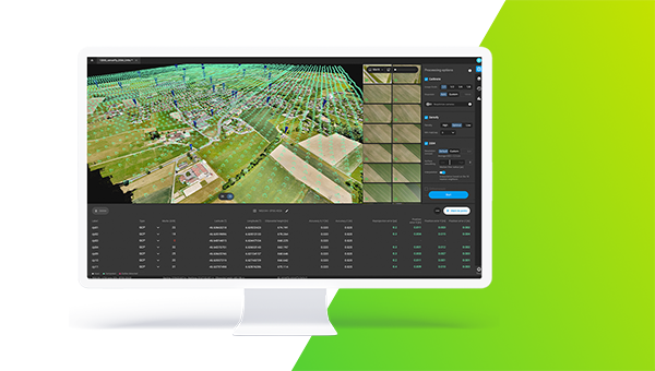
PIX4Dmapper

Annual
CHF 3,200 Yearly
  • Desktop application with floating license (use on up to 2 devices simultaneously)
  • Unlimited desktop processing and high-resolution outputs
  • Personal support and upgrades included during your subscription

PIX4Dmapper

Perpetual
CHF 4,490 /one-time
  • Desktop application with floating license (use on up to 1 devices)
  • Unlimited desktop processing and high-resolution outputs
  • Personal support and upgrades included during your subscription

buy Pix4DmaticPIX4Dmatic

The next-generation photogrammetry software for fast and accurate terrestrial, corridor, and large scale mapping.

Leverage the power of both photogrammetry and terrestrial LiDAR in the same application. Seamlessly export your point cloud into PIX4Dsurvey to create CAD-ready deliverables.

PIX4Dmatic

yearly subscription
CHF 3,500 Yearly
  • Desktop application with floating license (use on 1 device)
  • Unlimited desktop processing and high-resolution outputs
  • Personal support and upgrades included during your subscription

PIX4Dmatic

Perpetual
CHF 4,990 /one-time
  • Desktop application with floating license (use on 1 devices)
  • Unlimited desktop processing and high-resolution outputs
  • Personal support and upgrades included during your subscription
Scroll to Top